NO RESERVE
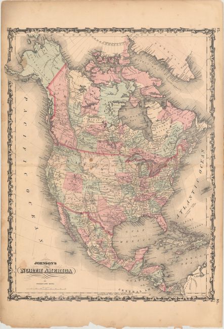
"Johnson's North America", Johnson & Ward
Subject: North America, Civil War
Period: 1862 (circa)
Publication:
Color: Hand Color
Size:
17.2 x 22.1 inches
43.7 x 56.1 cm
This early Civil War-period map shows the United States with some of the most interesting territorial borders. Foremost is the Confederate Territory of Arizona to the south of New Mexico Territory. Between August 1861 and July 1862, the Confederate General Baylor appointed himself the territorial governor and claimed all of New Mexico Territory south of the 34th Parallel for the Confederacy. Washington is in its rare inverted "L" configuration and the newly created Nevada appears west of Utah Territory which has Fillmore as its capital. Colorado is to the east of Utah with Colorado City and Pike's Peak are located, a likely reference to the Pike's Peak gold discoveries of 1859. Depicts railroads, completed and proposed, the U.S. Mail routes, and the route of the Pony Express. Also shows the locations of the major Indian tribes. A great example of the tremendous change in political boundaries taking place during the early years of the Civil War in the United States.
References:
Condition: B
Light toning, staining, and short fold separations that just touch the border at left and right. Several small chips are confined to the bottom edge of the sheet, away from the map image.