"Amerique Septentrionale", Levasseur, Victor
Subject: North America
Period: 1852 (circa)
Publication: Atlas Universel Illustre
Color: Hand Color
Size:
17.2 x 11.3 inches
43.7 x 28.7 cm
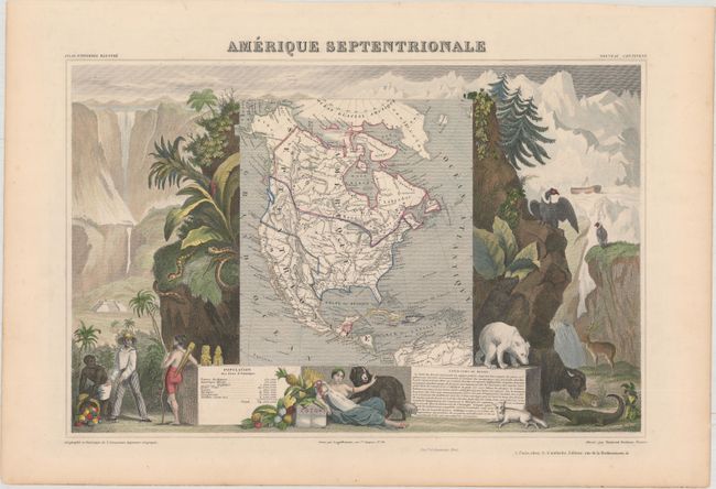
Victor Levasseur's "Atlas National Illustre" and "Atlas Universel Illustre" are among the last decorative atlases published. The maps are all lavishly illustrated with scenes of the countryside, products and activities indigenous to the region.
This richly engraved map shows the United States extending into present-day Canada reflecting the Oregon boundary dispute and Russia in control of Alaska. Texas is named and colored within the United States but engraved lines still show the republic borders. Mexico's northern border is drawn according to the Treaty of 1819 (here misprinted as 1810). Surrounded by beautifully engraved scenes of North and Central America including wildlife, a ship stranded in the polar sea and a Mayan temple.
References:
Condition: A
Original outline color with minor toning along sheet edges.