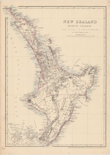
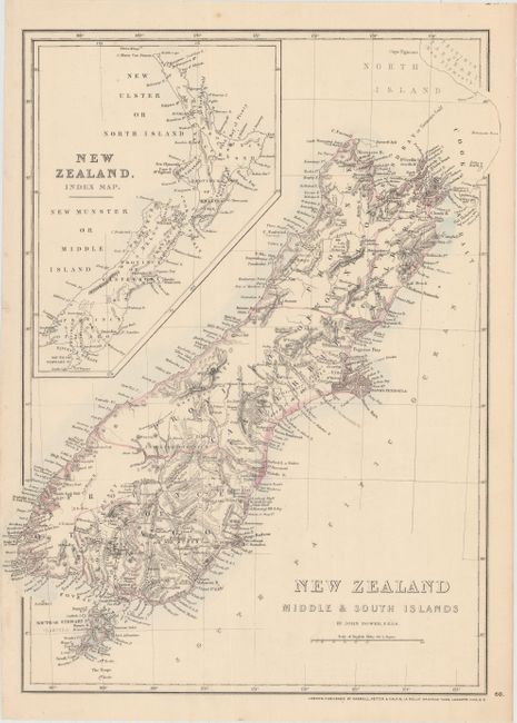
"[Lot of 2] New Zealand North Island New Ulster or Eaheinomauwe [and] New Zealand Middle & South Islands", Dower, John
Subject: New Zealand
Period: 1860 (circa)
Publication:
Color: Hand Color
Size:
12 x 17 inches
30.5 x 43.2 cm
These two maps provide a detailed look at the islands of New Zealand. The first sheet shows North Island (also referred to as New Ulster or Eaheinomauwe), while the second focuses on South Island (here called Middle Island) and Stewart Island (also labeled as South Island or Rakiura) south of Cook Strait. Both maps are teeming with details, including provinces, towns and cities, rivers, lakes, mountains, bays, smaller islands, and notes on the terrain. An inset on the second sheet zooms out to show New Zealand in full. Size varies slightly.
References:
Condition: A
Clean, bright examples with very minor marginal soiling.