Catalog Archive
Auction 159, Lot 701

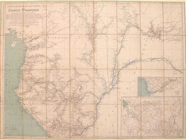
"Service Geographique des Colonies Congo Francais d'Apres les Itineraires Releves par Messieurs",

Subject: Western Africa

Period: 1895 (dated)

Publication:

Color: Printed Color

Size:
49 x 36.3 inches
124.5 x 92.2 cm
Download High Resolution Image
(or just click on image to launch the Zoom viewer)

This large, highly detailed map of western Africa is dissected into 32 panels and backed with linen. It depicts the present-day countries of Cameroon, Equatorial Guinea, Gabon, and the Republic of the Congo with two inset maps reaching further into the interior. The emphasis of the map is on the detailed river systems with the routes of numerous explorers (1866-1894) depicted in red overprinting. Produced by J. Hansen and lithographed by Monrocq in Paris. Folds into a marbled cardboard slipcase.

References:

Condition: B+

Issued folding with light soiling primarily along the left side of the map. Slipcase is moderately worn and chipped from use.

Estimate: $275 - $350

Sold for: $200

Closed on 9/14/2016

Archived