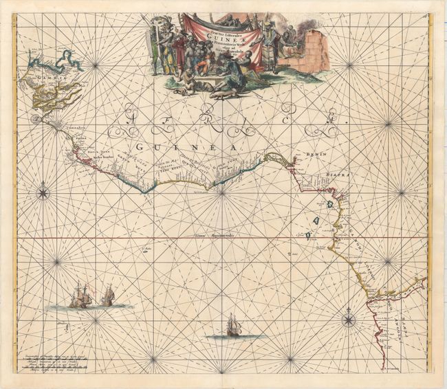
"Tractus Littorales Guineae a Promontorio Verde usque ad Sinum Catenbelae", Wit, Frederick de
Subject: Western Africa
Period: 1680 (circa)
Publication:
Color: Hand Color
Size:
22.4 x 19.4 inches
56.9 x 49.3 cm
This sea chart of the Coast of Guinea, a later issue of an original by Frederick de Wit, extends from modern-day Mauritania to Angola. To the north, the chart begins just beyond Cape Verde, includes the Gold, Ivory, and Grain Coasts, and continues to Catenbela Bay in the south. Three ships are shown in the sea below the coast, as well as two compass roses with rhumb lines. The cartouche is decorated with both European and native figures. In the foreground, two European men barter around a table, as one holds a scale. Three captives, referencing the slave trade, stand behind them. Above the title, a native woman and child sit in a hammock, observing the scene below.
References: cf. Norwich #253.
Condition: A
A clean and bright example with a dark impression and a professionally repaired centerfold separation at bottom.