"[Lot of 3] Northern India [and] Overland Route to India [and] Cabool, the Punjab and Beloochistan", Tallis, John
Subject: Southern Asia
Period: 1850 (circa)
Publication:
Color: Hand Color
The maps from The Illustrated Atlas were first published in serial form to a target audience that led insular lives due to the expense and hardship of travel. All that changed as the progress of the nineteenth century brought swift and dramatic changes in public awareness of far away places. Tallis' maps no doubt played an important role in this dramatic awakening. These maps not only provided up-to-date geographical knowledge, but also used vignette views within the map's design to show the native people and their occupations, cities and points of interest. The maps hark back to a cartographic tradition from the Dutch mapmakers of the seventeenth century with finely engraved decorative borders. The maps were drawn and engraved by John Rapkin with views drawn and engraved by a number of prominent artists. The maps were issued as a complete volume from 1851 until about 1865. Some of the maps were also published in other history books published by Tallis including British Colonies and, without the vignettes, in geographical dictionaries and encyclopedias until about 1880.
This lot of steel engraved maps is focused on southern Asia. Each of the maps is surrounded by a decorative border and embellished by a series of vignettes. The decorative borders and vignettes are uncolored, as issued.
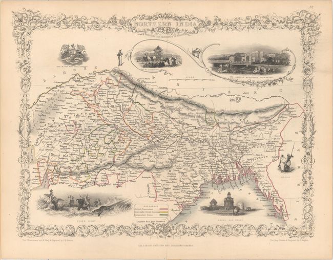
A. Northern India (12.5 x 9.7"). This map includes Nepal, Sikhim and Bhutan with vignettes surrounding the map including: Tiger Hunt; Ruins, Old Delhi; Car of Juggernaut, The British Residency, Hyderabad, and Seal of the Indian Company. Condition: On a clean sheet with one tiny fold separation confined to the bottom blank margin. (A)
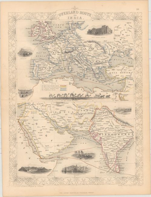
B. Overland Route to India (9.8 x 13"). Features two maps showing routes from Europe to India over land and by sea. The top map of Europe includes vignettes of the Post Office in London, Gibraltar, Malta and the Mail Crossing the Desert by way of camel caravan. Arabia and India are shown at the bottom with vignettes of Suez, Aden, Bombay and Madras. Condition: Pleasant light toning and a few minor spots. (A)
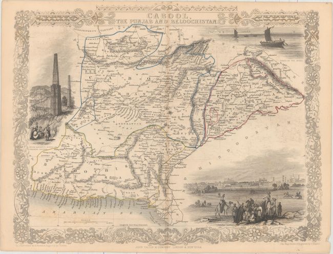
C. Cabool, the Punjab and Beloochistan (10.5 x 13.5"). Beautifully rendered map centered on Afghanistan. Vignettes include "Boats on the Indus," "Sultan Mahmoud's Minars and Fortress, Ghuznee," and a large view of "Lahore" with many warriors and camels in the foreground. Condition: Light printer's ink residue, faint offsetting, and a tiny pinhole along the centerfold. (B+)
References:
Condition:
Original outline color. See description above.