"Suchuen; et Xensi, Provinciae seu Praefecturae Regni Sinensis...", Jansson, Jan
Subject: China
Period: 1660 (circa)
Publication:
Color: Hand Color
Size:
21 x 18.6 inches
53.3 x 47.2 cm
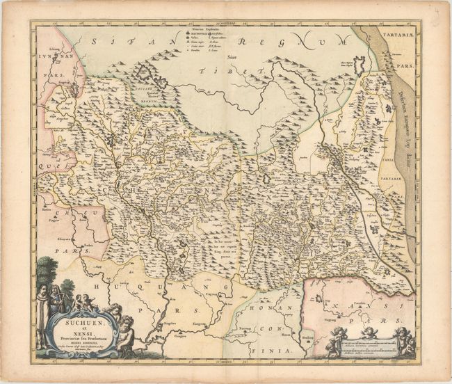
This superb map of central China is based upon the work of Jesuit Father Martino Martini who traveled through the region between 1643 and 1650. His work greatly advanced European knowledge of the region including the astronomical positions of many cities and topographical features. The map shows the provinces of Sichuan and Shaanxi with major towns and cities identified by tiny buildings including Chengdu (Chingtu) and Xi'an (Sigan), which was a starting point for the Silk Road. North is oriented to the right, with the Great Wall and Gobi Desert prominently depicted along the right side of the map. The title cartouche is flanked by a Chinese and Jesuit man and the scale of miles cartouche is surrounded by putti.
References:
Condition: B+
A dark impression with faint offsetting and an extraneous crease adjacent to the centerfold.