Catalog Archive
Auction 159, Lot 621

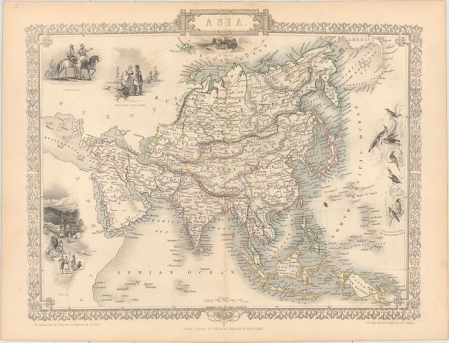
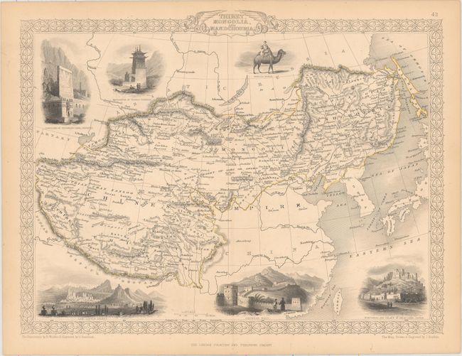
"[Lot of 2] Asia [and] Thibet, Mongolia, and Mandchouria", Tallis, John

Subject: Asia

Period: 1850 (circa)

Publication:

Color: Hand Color

Size:
See Description
Download High Resolution Image
(or just click on image to launch the Zoom viewer)

The maps from The Illustrated Atlas were first published in serial form to a target audience that led insular lives due to the expense and hardship of travel. All that changed as the progress of the nineteenth century brought swift and dramatic changes in public awareness of far away places. Tallis' maps no doubt played an important role in this dramatic awakening. These maps not only provided up-to-date geographical knowledge, but also used vignette views within the map's design to show the native people and their occupations, cities and points of interest. The maps hark back to a cartographic tradition from the Dutch mapmakers of the seventeenth century with finely engraved decorative borders. The maps were drawn and engraved by John Rapkin with views drawn and engraved by a number of prominent artists. The maps were issued as a complete volume from 1851 until about 1865. Some of the maps were also published in other history books published by Tallis including British Colonies and, without the vignettes, in geographical dictionaries and encyclopedias until about 1880.

A. Asia (12.5 x 10.1"). Finely engraved map of Asia that extends from Turkey through China and Russia to show a little of Alaska, and from the Arctic Ocean south to delineate all of the East Indies. It features beautifully engraved and rendered vignettes of Petra, Tartars, Russian peasants, walruses, and the sunbirds of India and the Philippines. Condition: Faint toning along the centerfold with one small rust spot below the title. (B+)

B. Thibet, Mongolia, and Mandchouria (12.8 x 9.6"). This fine steel engraved map features six vignettes and decorative borders. It covers the region from Tibet through northwestern China to Manchuria. Includes vignettes of the Fortress and Palace of Dalai Lama at Lassa, the Chinese Wall, Leh in Little Thibet and others. Condition: Pleasant light toning. (A)

The maps are surrounded by decorative borders. The illustrations are by J. Marchant and were engraved by J.B. Allen, and the maps were drawn and engraved by J. Rapkin.

References:

Condition:

Original outline color. See description above.

Estimate: $200 - $250

Sold for: $150

Closed on 9/14/2016

Archived