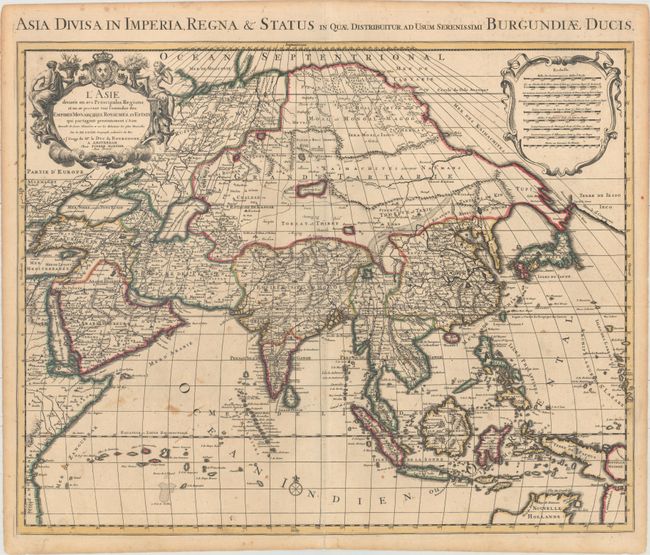
"L'Asie Divisee en ses Principales Regions, et ou se Peuvent Voir l'Estendue des Empires Monarchies, Royaumes, et Estats qui Partagent Presentement l'Asie...", Delisle/Mortier
Subject: Asia
Period: 1730 (circa)
Publication:
Color: Hand Color
Size:
23.1 x 18.5 inches
58.7 x 47 cm
An attractive map of Asia based on the Sanson-Jaillot map of 1692, with the now obsolete delineation of Siberia and Japan. The island of Hokkaido is attached to the mainland as part of the Yupi peninsula. Korea appears as an elongated peninsula, and the mythical Lac de Chiamay is shown as the source of five major rivers. Mortier updated the map to include the northern coastline of Australia (Nouvelle Hollande) based on the Delisle configuration of 1705. The upper corners contain a decorative title cartouche with a dedication to the Duc de Bourgogne and a scale of miles cartouche. The title appears in Latin above the map: "Asia Divisa in Imperia Regna & Status…"
References: cf. Yeo #119.
Condition: B+
Original color with an archivally repaired fold separation at bottom and occasional small stains in the image. Light toning is confined to the sheet edges.