Catalog Archive
Auction 159, Lot 575

"Lumen Historiarum per Orientem, Illustrandis Biblijs Sacris, Martijrologio, & alijs Multis a Fran. Hareio Concinnatum", Kaerius/Jansson

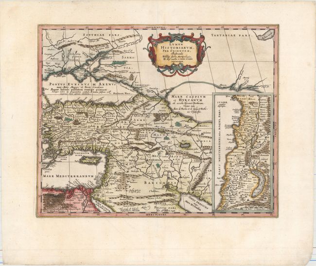
Subject: Eastern Mediterranean & Middle East

Period: 1684 (circa)

Publication:

Color: Hand Color

Size:
18.8 x 15.1 inches
47.8 x 38.4 cm
Download High Resolution Image
(or just click on image to launch the Zoom viewer)

Beautifully engraved map of the region from the eastern Mediterranean to the Persian Gulf based on the Ortelius/Vrients map of this title designed by Franciscus Haraeus. The map extends through Turkey and the Caucasus to include the region north of the Black Sea. Details include the pyramids in Egypt, the route of Abraham from Ur to Sichem, and the wandering of the Children of Israel. A large inset map of the Holy Land is shown at the right. This map was engraved by Kaerius, whose signature appears above the left hand bottom border, and published by Jansson.

References: Laor #323; Van der Krogt (Vol. I) #0821H:1.

Condition: A

A clean and bright example with very wide margins.

Estimate: $160 - $190

Sold for: $80

Closed on 9/14/2016

Archived