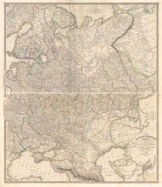
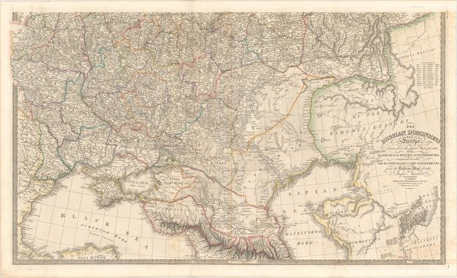
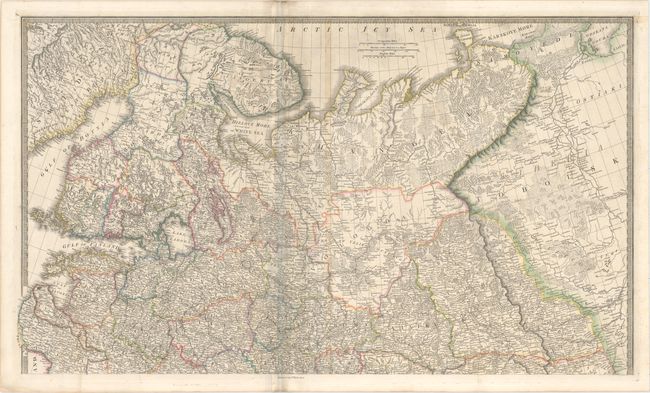
"[On 2 Sheets] The Russian Dominions in Europe Drawn from the Latest Maps, Printed, by the Academy of Sciences, St. Petersburg...", Wyld, James
Subject: Eastern Europe, Russia
Period: 1845 (dated)
Publication:
Color: Hand Color
Size:
36.5 x 21.2 inches
92.7 x 53.8 cm
Superb, large-scale map printed on two sheets of what was then known as White Russia. The map extends north through the Ukraine to Smolensk and east to the Caspian Sea on the southern map; and includes Finland, the Arctic Sea coast, Muscovia, Archangel, and parts of Siberia on the northern map. Filled with incredible detail including the post roads, ancient ruins and interesting notations. This map was originated by Jasper Nantiat drawn from the maps of the Academy of Sciences at St. Petersburg; this edition was published by James Wyld. Size is for each sheet - if joined the map would measure 36 x 42".
References:
Condition: B+
Issued folding with original outline color, minor soiling, and light offsetting. There are short separations along the left-hand fold that just enter the map image at the bottom of each sheet.