"[North Polar Map] Horizon de Paris",
Subject: North Pole
Period: 1739 (dated)
Publication:
Color: Hand Color
Size:
22.1 x 23.8 inches
56.1 x 60.5 cm
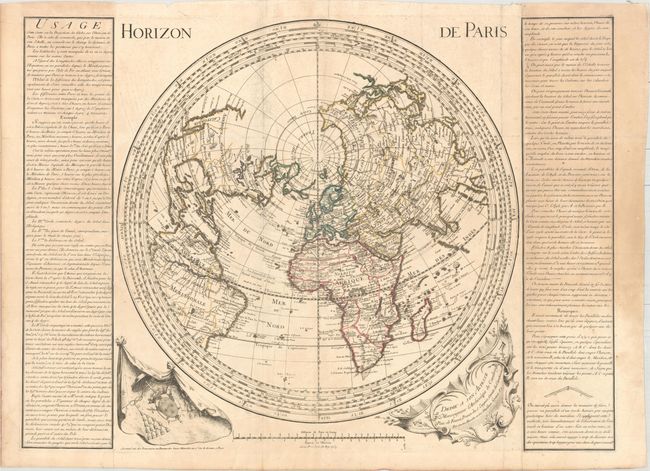
This unusual north polar projection is centered on Paris. Cartographically, the northwest coast of North America is incomplete ending at Cap Blanc and the interior is void of detail. Greenland appears to be attached to Canada, and the mythical Frisland appears below it. Nova Zembla is correctly shown as an island. Flanking the map are panels of French text describing astronomical calculations for Paris as the Prime Meridian. Adorned by a decorative dedication cartouche and coat of arms. Engraved by Desbruslins who, according to Tooley, worked for Jaillot and Buache. Full sheet with text measures 32.5 x 23.8".
References:
Condition: B+
Issued folding with light offsetting and a few short fold separations away from the map image. Panels of text are lightly toned.