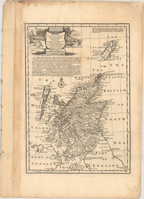
"A New and Accurate Map of Scotland. Compiled from Surveys, and the Most Approved Maps and Charts. The Whole Being Adjusted by Astronl. Observation", Bowen, Emanuel
Subject: Scotland
Period: 1747 (circa)
Publication: A Complete System of Geography
Color: Black & White
Size:
8.8 x 12.5 inches
22.4 x 31.8 cm
This map covers all of Scotland, extending north to the Shetland Islands. It is filled with place names and displays roads, rivers, lakes and basic topography. A note in the top right corner states that "The Dutch begin their Herring Fishery about these islands the 24th of June." The map is embellished by a drape-style title cartouche and surrounded by two hunting scenes. Emanuel Bowen was one of the leading English mapmakers of the 18th century. Unusually, he obtained royal appointments as engraver to both the French and English Royal Courts.
References:
Condition: B+
A dark impression with a few faint spots in the image and some toning and damp staining confined to the blank margins.