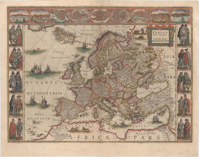
Blaeu's Carte-a-Figures Map of Europe
"Europa Recens Descripta", Blaeu, Willem
Subject: Europe
Period: 1659 (circa)
Publication: Nuevo Atlas
Color: Hand Color
Size:
21.9 x 16.1 inches
55.6 x 40.9 cm
This classic map of Europe is presented in the carte-de-figures style with vignettes on three sides. The upper frieze has nine bird's-eye views of Amsterdam, Prague, Constantinople, Venice, Rome, Paris, London, Toledo and Lisbon. The side borders contain the costumes of the noblemen and women of ten European nations. The map is embellished with sailing ships, sea monsters, bears and Neptune riding a dolphin and holding his trident. A beautiful map produced at the height of the Golden Age of Dutch mapmaking; it was included in the first volume of Blaeu's magnificent atlas. Spanish text on verso, published between 1659-72.
References: Goss (Blaeu) #4, p.30; Van der Krogt (Vol. II) #1000:2.
Condition: B+
Watermarked paper with full original color that has been partially refreshed and light soiling. There are professional repairs to several separations along the centerfold and to a tear across the bottom left corner of the figures vignette.