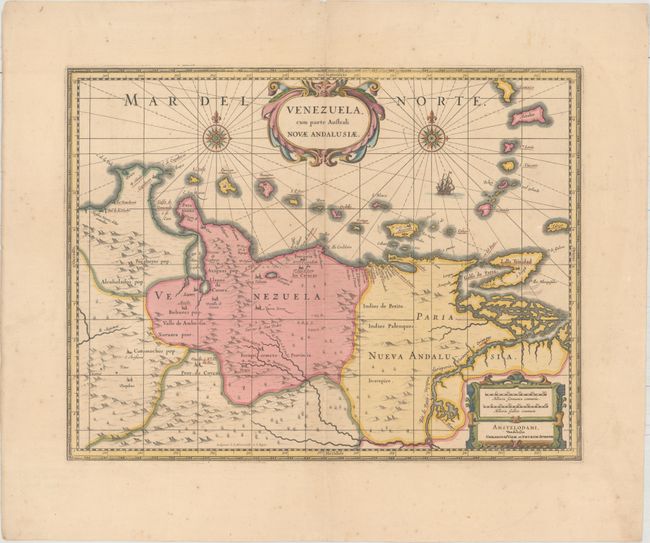
"Venezuela, cum Parte Australi Novae Andalusiae", Hondius/Schenk & Valck
Subject: Venezuela
Period: 1710 (circa)
Publication:
Color: Hand Color
Size:
19.1 x 14.6 inches
48.5 x 37.1 cm
This beautifully engraved map is based on the cartography of Hessel Gerritsz. It covers the northern coast of South America, Venezuela, east to the mouth of the Orinoco, and includes the offshore islands from Aruba through Dominica and Tobago. The fine engraving illustrates the mountains, forests, rivers and missions in the interior, but shows place names primarily along the coastlines owing to the relatively few explorations made into the interior. The map is richly embellished with title and distance scale cartouches, compass roses and a galleon. Engraved by E.S. Hamers-veldt and S. Rogeri and first issued by Henricus Hondius; this being the Valk & Schenk edition.
References: cf. Van der Krogt (Vol. I) #9830:1.1.
Condition: A
Overall fine with lovely original color in the map and later color in the decorative elements. There is some faint foxing in the blank margins.