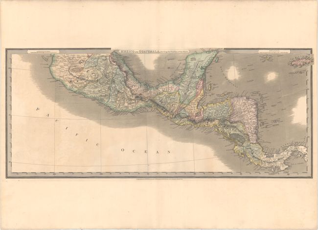
"Mexico and Guatemala, Shewing the Position of the Mines", Wyld, James
Subject: Central America
Period: 1827 (dated)
Publication:
Color: Hand Color
Size:
31.5 x 13.3 inches
80 x 33.8 cm
This map of Central America extends from the southern half of Mexico to Panama and includes the Grand Cayman, Little Cayman, and Jamaica. The map is filled with detail, including political boundaries, place names, rivers, and topography shown by hachure. Nicaragua is divided into two, with the larger eastern portion labeled Mosquito Coast. Panama is also called Colombia, and British Settlements are noted along the coast of present-day Belize.
References:
Condition: B+
Full original color on paper with a "Ruse & Turners 1831" watermark. There is mild toning and offsetting.