Catalog Archive
Auction 159, Lot 318

"De Landschappen Tabasco en Iucatan Tussen de Golf van Mexico en de Zuyd Zee Gelegen", Aa, Pieter van der
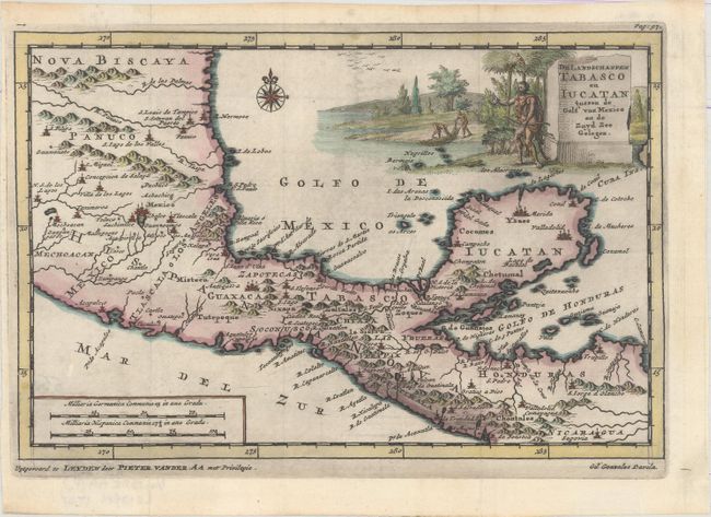
Subject: Mexico & Central America

Period: 1707 (circa)

Publication: Naauwkeurige Versameling der Gedenk-Waardigste Zee en Landreysen…

Color: Hand Color

Size:
9 x 6 inches
22.9 x 15.2 cm
Download High Resolution Image
(or just click on image to launch the Zoom viewer)

This finely engraved map of southern Mexico and part of Central America down to Nicaragua was designed to illustrate the expedition of Spanish Conquistador Gil Gonzalez Davila. From 1522-24, Gonzalez made his way through Costa Rica, Nicaragua, and Honduras, baptizing Natives and acquiring sizeable amounts of pearls and gold. The title cartouche includes a Native with a bow with others seining for fish. This map was published in Van der Aa's compilation of early voyages of exploration.

References: Kapp (MCC-103) #27; cf. Shirley (BL Atlases) G.AA-1a #50.

Condition: A

A dark, crisp impression issued folding with a hint of offsetting. Minor toning and soiling in blank margins.

Estimate: $200 - $230

Sold for: $130

Closed on 9/14/2016

Archived