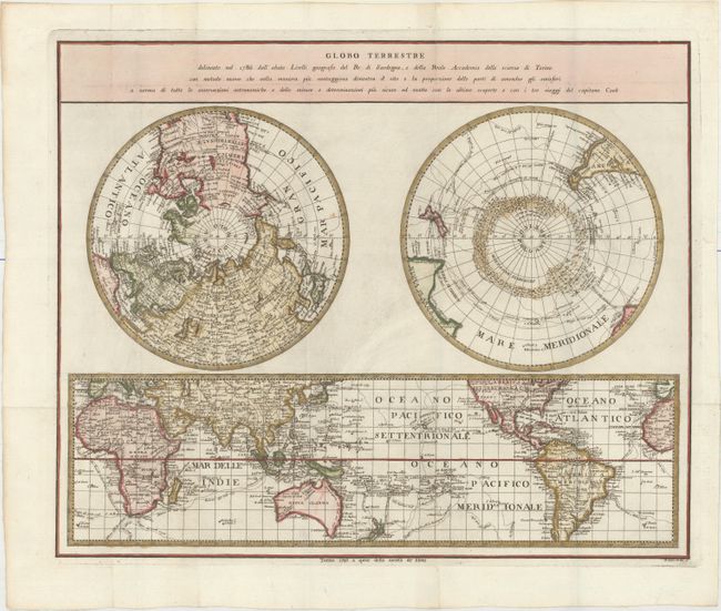
"Globo Terrestre Delineato nel 1786 dall' Abate Lirelii Geografo de Re di Sardegna e della Reale Accademia delle Scienze di Torino...",
Subject: World
Period: 1793 (dated)
Publication:
Color: Hand Color
Size:
17.8 x 14.6 inches
45.2 x 37.1 cm
This uncommon map is a slightly-reduced version of Salvador Lirelli's map, which was published in 1786 for the Royal Academy of Science in Torino. The sheet includes two polar projections and a world map on Mercator's projection, centered on the Pacific. The focus of the maps is Captain Cook's voyages, which are traced throughout along with the dates of each leg of his travels. The south polar hemisphere depicts mountains of ice surrounding the pole, but no landmass is shown. The map on Mercator's projection shows Australia named Nuova Olanda and still connected to Tasmania, although the coastline is beginning to take shape. Engraved by P. Amati and P. Tela.
References: cf. Tooley (MCC-2) #79.
Condition: A
A crisp impression, issued folding on watermarked paper with attractive color and a couple of small, insignificant spots.