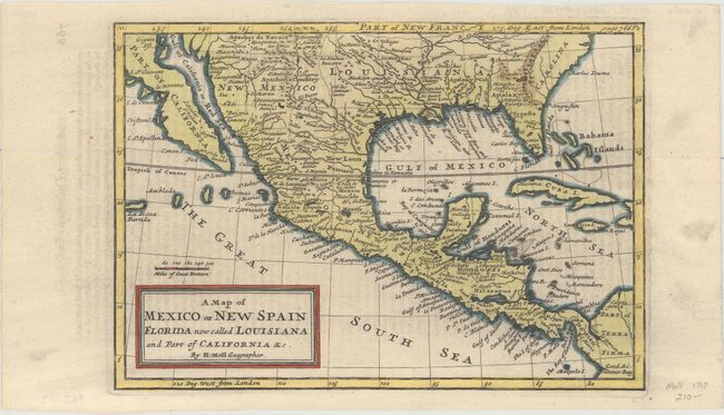
"A Map of Mexico or New Spain Florida Now Called Louisiana and Part of California &c.", Moll, Herman
Subject: Southern United States, Mexico & Central America
Period: 1745 (circa)
Publication:
Color: Hand Color
Size:
10.1 x 7.1 inches
25.7 x 18 cm
This uncommon, copper engraved map includes good detail throughout, such as many Indian names and early forts. The area extends from about the 37th parallel just to South America in Terra Firma. The only British colony shown is a large Carolina. The Spanish possession of Louisiana includes Florida and extends to the Rio Grande (here called the North R). Texas is not named but is inhabited by White and Black Spaniards, and Country full of Beevers. The Baja is distorted and the Gulf of California extends too far north. Although only Part of California is shown, it is assumed that it is in the form of an island because Moll depicts California as an island on his other maps.
References: McLaughlin #180.
Condition: A
A nice impression with attractive color and faint offsetting from an opposing page of text.