A Great Set of Hawaii Territory Maps
"[Lot of 8] Hawaii Hawaiian Islands [and] Kauai... [and] Lanai... [and] Maui County... [and] Maui... [and] Molokai [and] Niihau... [and] Oahu... ", U.S. Government
Subject: Hawaii
Period: 1897-1906 (dated)
Publication:
Color: Printed Color
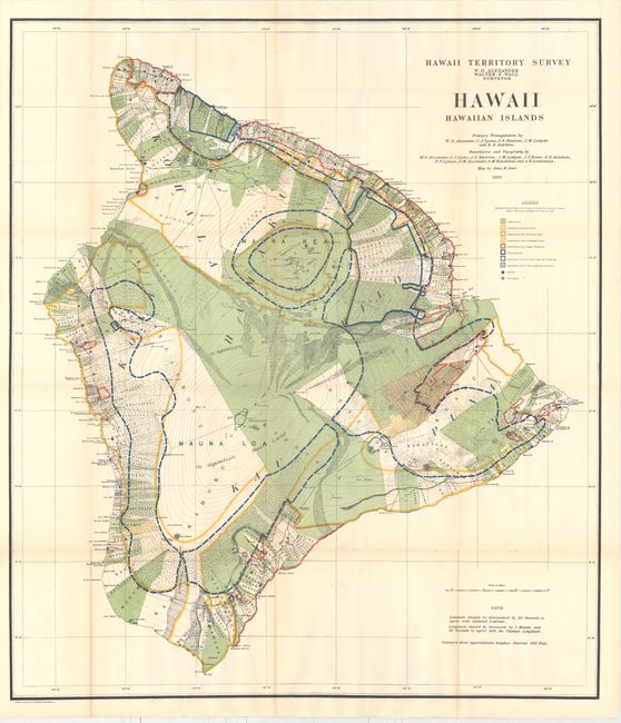
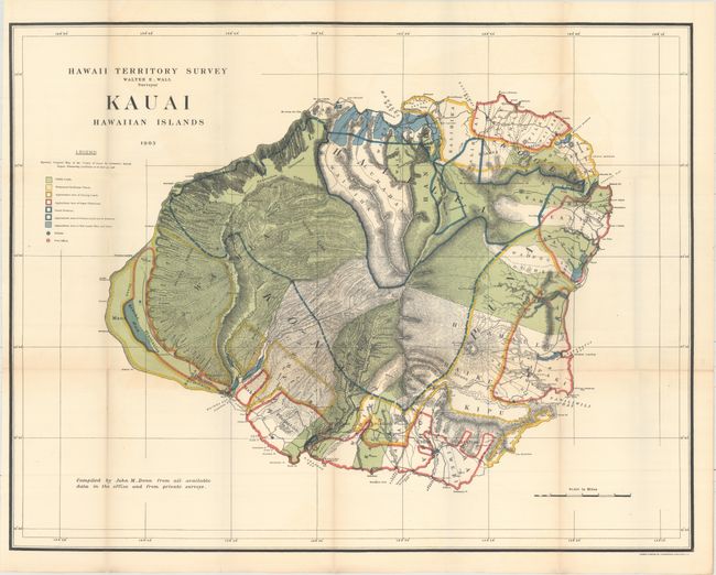
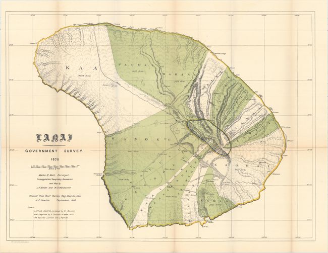
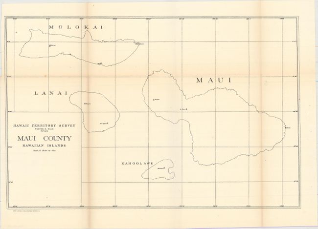
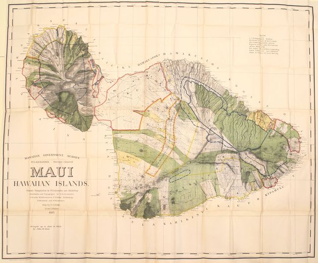
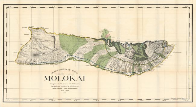
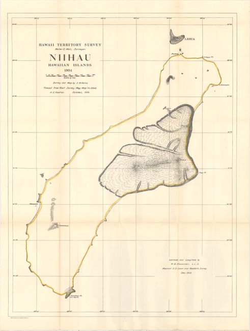
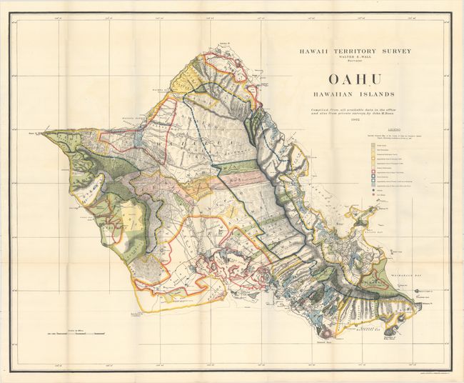
A terrific collection of maps of the Hawaii Territory as surveyed by W.D. Alexander and Walter E. Wall. Each is filled with colorful details including the location of Public Lands, Homestead Settlement Tracts, Grazing Lands, Pineapple Lands, Sugar Plantations, Forest Reserves, Forest Lands, Wet Lands, and more. The maps are stamped on verso 1 through 9 with number 2 not present. All maps with the exception of #4 are in printed color. Lot includes the following maps:
A. Hawaii Hawaiian Islands, dated 1901 (31.8 x 36.3").
B. Kauai Hawaiian Islands, dated 1903 (30.3 x 23.5").
C. Lanai Hawaiian Islands, dated 1906 (26.3 x 19.7").
D. Maui County Hawaiian Islands (16.9 x 11.1").
E. Maui Hawaiian Islands, dated 1903 (53.3 x 43.4").
F. Molokai, dated 1897 (48.3 x 25.3").
G. Niihau Hawaiian Islands, dated 1906 (19.3 x 25.4").
H. Oahu Hawaiian Islands, dated 1906 (33.2 x 27.1").
References:
Condition: B+
Overall clean and bright with occasional faint toning or minor offsetting that does not distract. The map of Hawaii has an edge tear at bottom that extends 4" into the image that has been closed on verso with archival tape.