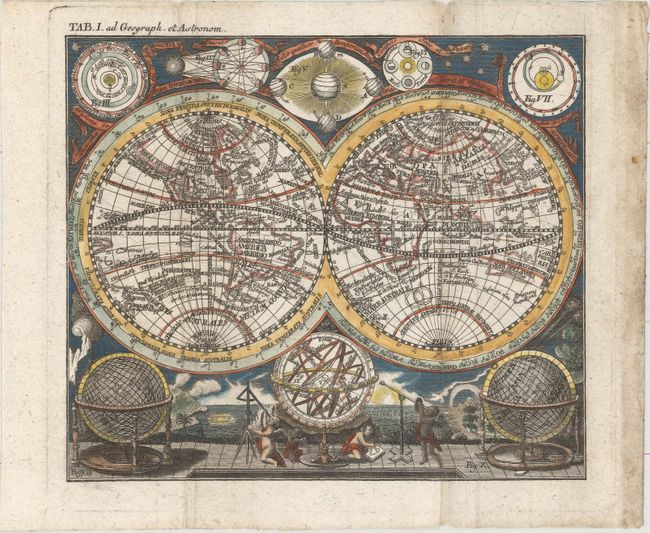
"Planisphaerium Terrestre...",
Subject: World
Period: 1760 (circa)
Publication: Hubner's Staats Zeitungs Lexicon
Color: Hand Color
Size:
8.5 x 7.4 inches
21.6 x 18.8 cm
Small and very decorative double hemisphere map with California depicted as an island. Australia includes the western and northern coasts and the discoveries of Van Diemen. There are numerous Pacific islands including much of the western coastline of New Zealand. Numerous exploration routes are traced. Five astronomical diagrams decorate the top of the map. At the base is a pair of globes and an armillary sphere, which is surrounded by putti using a variety of navigational instruments. The background is taken from a map by Homann displaying natural phenomenon such as volcanoes, earthquakes, waterspouts and a rainbow. In the top left margin is "Tab. I. ad Geograph et Astronom." Published in Johann Hubner's Staats Zeitungs Lexicon.
References:
Condition: B+
A crisp impression, issued folding with light toning along one fold and in the right blank margin. There are a couple of tiny worm tracks only visible when held to light.