Catalog Archive
Auction 159, Lot 194

Blaeu's Decorative Map of the Southeast

"Virginiae Partis Australis, et Floridae Partis Orientalis, Interjacentiumq Regionum Nova Descriptio", Blaeu, Willem

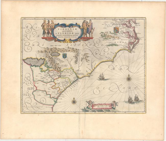
Subject: Colonial Southeastern United States

Period: 1663 (published)

Publication: Le Grand Atlas

Color: Hand Color

Size:
19.9 x 15.2 inches
50.5 x 38.6 cm
Download High Resolution Image
(or just click on image to launch the Zoom viewer)

This lovely map of the Southeast extends from the southern part of Chesapeake Bay to northern Florida. Cartographically it improves on the Hondius map of 1606, on which it was derived, with the Chesapeake Bay correctly indicated as a large bay and the Carolinas and Georgian coasts depicted more accurately. The map presents the English and French colonial interests in the region as depicted by their respective royal arms. At the southern end of the Appalachians is a note concerning gold and silver mines. Richly decorated with a large cartouche flanked by Native Americans. The Atlantic Ocean contains two compass roses, three sailing ships and two aquatic putti holding the German scale of miles. This is the second state of the map with French text on verso.

References: Burden #253; Van der Krogt (Vol. II) #9400:2.

Condition: A

Original color on watermarked paper with very wide margins. There is a printer's crease to the right of the centerfold at bottom and printer's ink residue, particularly along the centerfold.

Estimate: $1,600 - $1,900

Sold for: $800

Closed on 9/14/2016

Archived