Catalog Archive
Auction 159, Lot 180

"Nouvelle Carte de la Pensylvanie Maryland, Virginie et Nouvelle Iarsey", Blome, Richard

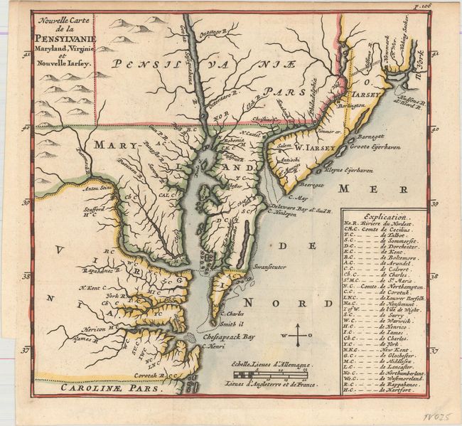
Subject: Colonial Mid-Atlantic United States

Period: 1688 (circa)

Publication: L'Amerique Angloise, ou Description des Isles et Terres du Roi d'Angleterre...

Color: Hand Color

Size:
6.6 x 6.1 inches
16.8 x 15.5 cm
Download High Resolution Image
(or just click on image to launch the Zoom viewer)

This map was published in Abraham Wolfgang's French translation of Richard Blome's The Present State of His Majesties Isles and Territories in America. The map extends from the New York Harbor in the north to the border of North Carolina in the south. The various counties are identified with abbreviations, which are explained in a table at bottom right. The map shows the boundary between Pennsylvania and Maryland too far north, yet correctly shows the boundary between Maryland and Virginia along the south bank of the Potomac River, which was often mis-placed in the middle of the Potomac River on maps. New Jersey is divided into east and west. This is the second state, with Cheseapeack Bay and an additional item added to the Explication.

References: Burden #640.

Condition: A

Issued folding on watermarked paper with very minor offsetting at top and a couple of faint spots.

Estimate: $700 - $850

Sold for: $600

Closed on 9/14/2016

Archived