Catalog Archive
Auction 159, Lot 177

"Nova Virginiae Tabula", Jansson, Jan

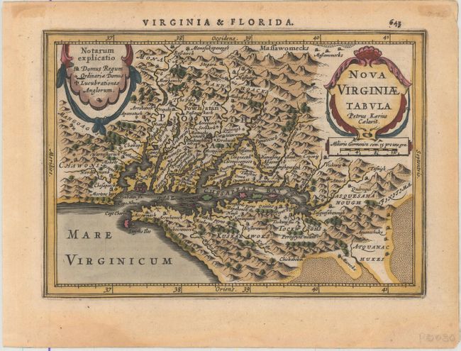
Subject: Colonial Mid-Atlantic United States

Period: 1628 (published)

Publication: Atlas Minor

Color: Hand Color

Size:
7.5 x 5.3 inches
19.1 x 13.5 cm
Download High Resolution Image
(or just click on image to launch the Zoom viewer)

This delicately engraved map is a reduced version of John Smith's map of the Chesapeake Bay region. Despite its small size, it is filled with pictorial topography and towns with both English and Native names, including Jamestown (Iamestowne). A key appears in a delicate cartouche at top left. Engraved by Pieter van den Keere with his Latinized name appearing in the title cartouche. Latin text on verso, from the first edition of Jansson's Atlas Minor, with new plates by Van den Keere and Abraham Goos.

References: Burden #223; Van der Krogt (Vol. III) #9410:352A.1.

Condition: A

A superb impression with attractive color on watermarked paper. There is light toning along the edges of the sheet.

Estimate: $750 - $900

Sold for: $550

Closed on 9/14/2016

Archived