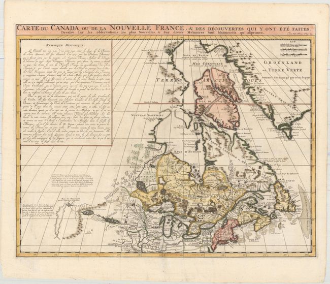
"Carte du Canada ou de la Nouvelle France, & des Decouvertes qui y ont ete Faites, Dressee sur les Observations les Plus Nouvelles, & sur Divers Memoires tant Manuscrits qu' Imprimez", Chatelain, Henry Abraham
Subject: Colonial Northeastern United States & Canada
Period: 1719 (circa)
Publication: Atlas Historique...
Color: Hand Color
Size:
20.7 x 16.1 inches
52.6 x 40.9 cm
This richly detailed map, copied from Delisle, provides the most accurate rendering of the Great Lakes of the time, with the lakes fully enclosed and properly placed in longitude and latitude. The map is largely based on the reports of Lahontan, Louis Hennepin, Jean Franquelin and Louis Jolliet. It depicts the Riviere Longue stretching westward with a notation concerning the possibility of a navigable passage to the Pacific. The large French text inset (Remarque Historique) tells the story of the discovery of Canada by fishermen from Brittany who were shipwrecked in 1504. The expeditions of Verazzano and Cabot are also mentioned.
References: Kershaw #334; Phillips (Atlases) #548.
Condition: A
A crisp impression on watermarked paper with light soiling in the bottom blank margin.