"[Lot of 4] British America [and] West Canada [and] East Canada, and New Brunswick [and] Newfoundland and Nova Scotia", Tallis, John
Subject: Canada
Period: 1850 (circa)
Publication:
Color: Hand Color
Size:
12.9 x 10.1 inches
32.8 x 25.7 cm
The maps from The Illustrated Atlas were first published in serial form to a target audience that led insular lives due to the expense and hardship of travel. All that changed as the progress of the nineteenth century brought swift and dramatic changes in public awareness of far away places. Tallis' maps no doubt played an important role in this dramatic awakening. These maps not only provided up-to-date geographical knowledge, but also used vignette views within the map's design to show the native people and their occupations, cities and points of interest. The maps hark back to a cartographic tradition from the Dutch mapmakers of the seventeenth century with finely engraved decorative borders. The maps were drawn and engraved by John Rapkin with views drawn and engraved by a number of prominent artists. The maps were issued as a complete volume from 1851 until about 1865. Some of the maps were also published in other history books published by Tallis including British Colonies and, without the vignettes, in geographical dictionaries and encyclopedias until about 1880.
A nice set of decorative maps of Canada, engraved and expertly rendered by John Rapkin.
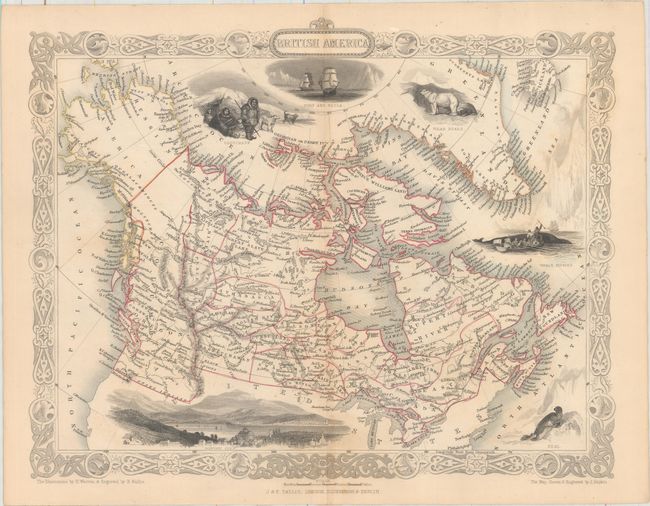
A. British America extends to show all of today's Canada and Alaska, here called Russian America. In Canada, at least 23 districts are outlined. Dots indicate the numerous forts and principal stations of the Hudson's Bay Company. This edition includes a bird's-eye view of Boston City, a seal, whale fishing, Eskimo (here called Esquimaux), polar bears, and a nautical scene showing the ships Fury and Hecla, which made expeditions to the Arctic in search of the Northwest Passage under William Edward Parry.
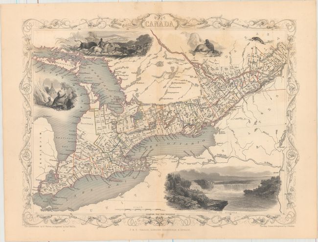
B. West Canada covers the region of present-day Ontario and includes uncolored vignettes of Niagara Falls, an Indian encampment, and river otters.
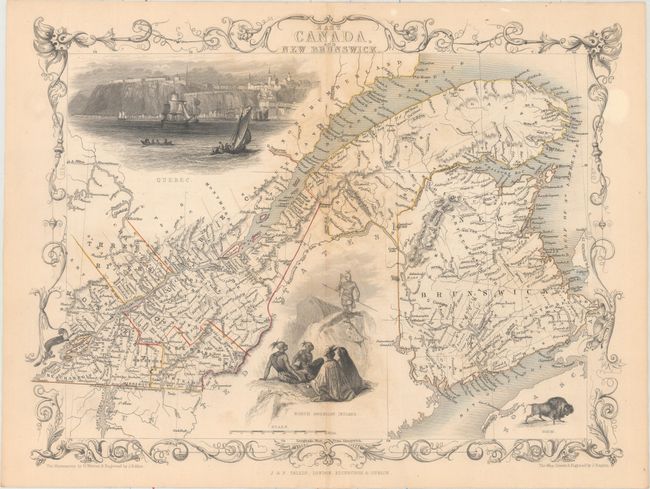
C. East Canada, and New Brunswick is a fine map of the St. Lawrence River and New Brunswick. There are two large vignettes: a group of North American Indians, and a lovely view of Quebec with numerous sailing ships and boats in the foreground.
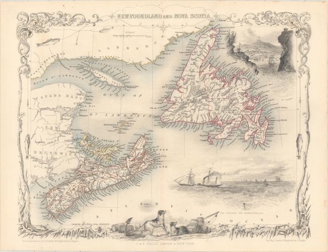
D. Nova Scotia and Newfoundland is a lovely engraved map of the region including parts of New Brunswick and Labrador. The map includes vignettes of Halifax, steam and sailing ships in the Cod Fishery off Newfoundland, and a pair of dogs. The decorative border features ice and fish caught on fishing lines.
References:
Condition: B+
Original outline color with pleasant light toning and color offsetting along the centerfold of East and West Canada.