Catalog Archive
Auction 158, Lot 70

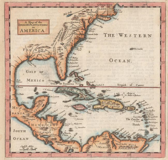
"A Map of the English Plantations in America", Moll, Herman

Subject: Colonial Eastern North America & West Indies

Period: 1701 (circa)

Publication: A System of Geography...

Color: Hand Color

Size:
7.3 x 7.1 inches
18.5 x 18 cm
Download High Resolution Image
(or just click on image to launch the Zoom viewer)

This handsome map is centered on Cuba and extends to the Caribbean, Central America, and north to New England. The topography is indicated simply and includes an unusual Felis Lake west of Pennsylvania. The early colonial settlements of Boston, Cape Cod, James Towne, and Charles Towne are noted. On a full sheet of English text that measures 8.4 x 12.1".

References: Philipps (Atlases) #536.

Condition: B+

On a watermarked sheet that has been remargined at left and right to better accommodate framing. There is a 4" repaired tear in a blank space below the map image and a few faint damp stains in the margins.

Estimate: $350 - $425

Sold for: $180

Closed on 6/22/2016

Archived