Catalog Archive
Auction 158, Lot 69

"Carte du Continent de l'Amerique Nord pour Servir a l'Intelligence du Systeme des Vents et des Courans...", Volney, C. F.

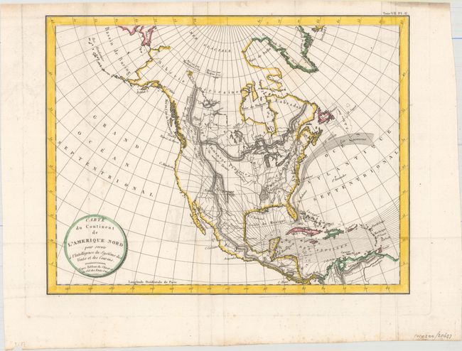
Subject: North America

Period: 1803 (circa)

Publication: Tableau du Climat et du Sol des Etats-Unis d'Amerique...

Color: Hand Color

Size:
13 x 10 inches
33 x 25.4 cm
Download High Resolution Image
(or just click on image to launch the Zoom viewer)

The currents and prevailing winds across North America and the Caribbean are featured on this early thematic map. The Gulf Stream is shown flowing through the Canal de Bahamas and then north to Nova Scotia, with both the old and new course identified. The trade winds are shown blowing west through the Antilles and then curving north and flowing out into the United States. Interior detail is limited to rivers and mountain ranges. Names Santa Fe, Acapulco, Mexico City and Vera Cruz, and locates the Mosquito Coast in Belize and Honduras, and the Isthmus of Panama.

Constantin-Francois de Chasseboeuf, Comte de Volney was a French philosopher, historian, and politician. He began his travels within North America in 1795, and in 1797 he was accused by the John Adams' administration of being a French spy sent to prepare for the reoccupation of Louisiana by France.

References: Howes #V141.

Condition: B+

Issued folding with faint offsetting and a bit of paper weakness along the left platemark.

Estimate: $200 - $250

Unsold

Closed on 6/22/2016

Archived