Catalog Archive
Auction 158, Lot 468

NO RESERVE

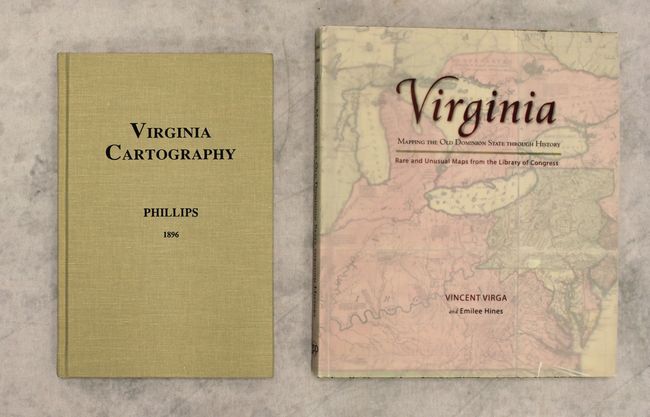
"[Lot of 2] Virginia Cartography - A Bibliographical Description [and] Virginia - Mapping the Old Dominion State Through History - Rare and Unusual Maps from the Library of Congress",
Subject: References

Period: 1995-2010 (published)

Publication:

Color:

Size:
See Description
Download High Resolution Image
(or just click on image to launch the Zoom viewer)

A. Virginia Cartography - A Bibliographical Description, by P. Lee Phillips, published 1995, black & white (6.1 x 9.3"). Originally published by the Smithsonian Institution in 1896, this is a reprint of Phillips' book, with an introduction by F.J. Manasek. This bibliographic monograph contains lengthy descriptions of some 200 maps of Virginia, one of the earliest Europeanized regions of America. The list begins with White's map of 1585 and ends with the Rand McNally map of 1893. 85 pages, hardbound in beige cloth. Condition: Like new. (A+)

B. Virginia - Mapping the Old Dominion State Through History - Rare and Unusual Maps from the Library of Congress, by Vincent Virga and Emilee Hines, published 2010, printed color (8.8 x 10.1"). This extensively illustrated book relays the story of Virginia through its maps, tracking the state's evolution through its various cartographic representations. It starts with White's 1585 map of the coast of present-day North Carolina and finishes over three centuries later with a map of Richmond and Petersburg and their vicinities from 1907. There is a foreword by acclaimed author and picture editor Vincent Virga. The maps (most in color) are accompanied by brief essays by author and native Virginian Emilee Hines. 117 pp. Hardbound with illustrated covers and a translucent dust jacket with the title on it. Condition: Contents and covers tight. There is some slight shelf wear and a short tear at bottom on the dust jacket. (A)

References:

Condition:

See description above.

Estimate: $60 - $80

Sold for: $26

Closed on 6/22/2016

Archived