Catalog Archive
Auction 158, Lot 455

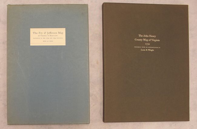
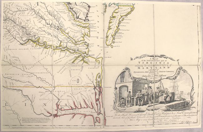
"[Lot of 2] The Fry & Jefferson Map of Virginia and Maryland - Facsimiles of the 1754 and 1794 Printings with an Index [and] The John Henry County Map of Virginia 1770 - A Facsimile of the Copy in the Library of Congress",

Subject: References

Period: 1966-77 (published)

Publication:

Color: Black & White

Size:
See Description
Download High Resolution Image
(or just click on image to launch the Zoom viewer)

A. The Fry & Jefferson Map of Virginia and Maryland - Facsimiles of the 1754 and 1794 Printings with an Index, by the University Press of Virginia, published 1966 (9.4 x 13.8"). This is the second edition of this impressive set of facsimiles of the legendary Fry-Jefferson map of Virginia. Colonel Joshua Fry and Peter Jefferson (the father of Thomas Jefferson) were appointed by Lewis Burwell, the acting governor of Virginia, to draft a new map of the colony that took into account the extent of English settlement on the frontiers and the potential French encroachment in those areas claimed by the British. Fry and Jefferson, then surveyor and deputy surveyor for Albemarle County respectively, were ideal appointees for the project as they had accumulated a substantial amount of information from their work on the backcountry, the Northern Neck controversy, and the westward extension of the border between Virginia and North Carolina. Their knowledge, along with reports received from their acquaintances who had explored the western territories, produced the most detailed account of the inhabited parts of the colony. Here, the 1754 and 1794 printings are reproduced, both split over four sheets that would measure approximately 49.5 x 31" if joined. The earlier edition features outline color. These maps are accompanied by a slim volume that contains an introduction, background information on the map, a comprehensive publishing history of the map, and more. 48 pp., bound in blue paper. The maps and book are loose in a hardbound blue portfolio that tucks into a blue cardboard slipcase. One of only 500 copies printed. Condition: The maps and book are in fine condition. The slipcase is lightly sunned and soiled, with minor shelf wear.

B. The John Henry County Map of Virginia 1770 - A Facsimile of the Copy in the Library of Congress, by the University Press of Virginia, published 1977 (10.5 x 14.1"). This is a handsome facsimile edition of John Henry's often forgotten map, A New and Accurate Map of Virginia Wherein Most of the Counties Are Laid Down from Actual Surveys..., originally published in 1770. Henry was the father of Patrick Henry and "a dreamer of dreams and a patriot," according to Louis B. Wright in his informative introduction to this edition. Although his map was attacked for its inaccuracies when it was published, it now serves as an invaluable resource for those studying the history of colonial Virginia thanks to its inclusion of both new and old county lines and its relatively comprehensive identification of the colony's plantations. It was engraved and published by Thomas Jefferys. The facsimile was copied from the example in the Library of Congress and printed on four sheets that would measure approximately 53 x 39" if joined. The four sheets and Wright's introduction are inserted into a firm brown portfolio, which slips into a brown slipcase with gilt titling across the front. One of 500 copies. Condition: The map and introduction are in fine condition. Slipcase has very minor shelf wear.

References:

Condition: A

See description above.

Estimate: $350 - $425

Sold for: $375

Closed on 6/22/2016

Archived