Catalog Archive
Auction 158, Lot 383

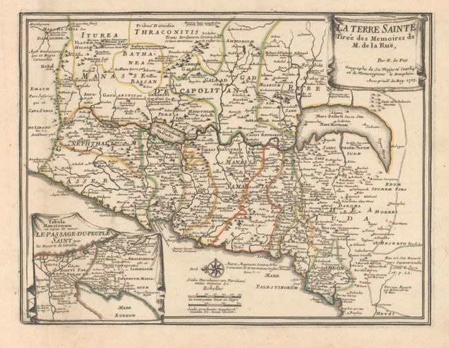
"La Terre Sainte Tiree des Memoires de M. de la Rue", Fer, Nicolas de

Subject: Holy Land

Period: 1703 (dated)

Publication: L'Atlas Curieux

Color: Hand Color

Size:
12.1 x 9.2 inches
30.7 x 23.4 cm
Download High Resolution Image
(or just click on image to launch the Zoom viewer)

This map, with north oriented to the left, shows the twelve tribes situated on both sides of the Jordan River according to Roman political divisions. The Kishon River is depicted connecting the Sea of Galilee with Haifa Bay, and the Dead Sea is in a crescent shape. Includes an inset of the Sinai Peninsula showing the Exodus. Above the map is an attached sheet of explanatory French text. The two sheets combined measure 14.4 x 19.4".

References: Laor #271.

Condition: B+

Original outline color on watermarked paper with minor soiling and printer's ink residue.

Estimate: $170 - $200

Sold for: $100

Closed on 6/22/2016

Archived