Catalog Archive
Auction 158, Lot 234

Early Example of Speed's Resplendent Map of Oxfordshire

"Oxfordshire Described, with ye Citie and the Armes of the Colledges of yt Famous University ", Speed, John

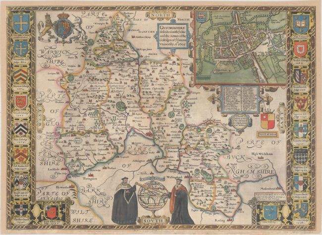
Subject: Southern England

Period: 1605 (dated)

Publication: The Theatre of the Empire of Great Britaine

Color: Hand Color

Size:
20.9 x 15.3 inches
53.1 x 38.9 cm
Download High Resolution Image
(or just click on image to launch the Zoom viewer)

Speed's stunning map of Oxfordshire is centered on the city of Oxford and includes a bird's-eye plan of the city in an inset at top, with a key below identifying important locations. Flanking the map are the coats of arms of Oxford University and its numerous colleges, with the approximate dates of their founding. Further embellishments include the Royal Arms and a pair of scholars studying a large terrestrial globe. English text on verso with a description of the county.

References: Shirley (BL Atlases) T.SPE-1b.

Condition: B+

A nice impression on watermarked paper with light soiling, some printer's ink residue, and a couple of short, professionally repaired edge tears that just enter border. The left, top and right margins have been professionally extended to accommodate framing.

Estimate: $1,900 - $2,200

Sold for: $900

Closed on 6/22/2016

Archived