Catalog Archive
Auction 158, Lot 223

Interesting Political Map Showing Confederation of the Rhine

"L'Europe dans son Etat Actuel", Picquet, Charles
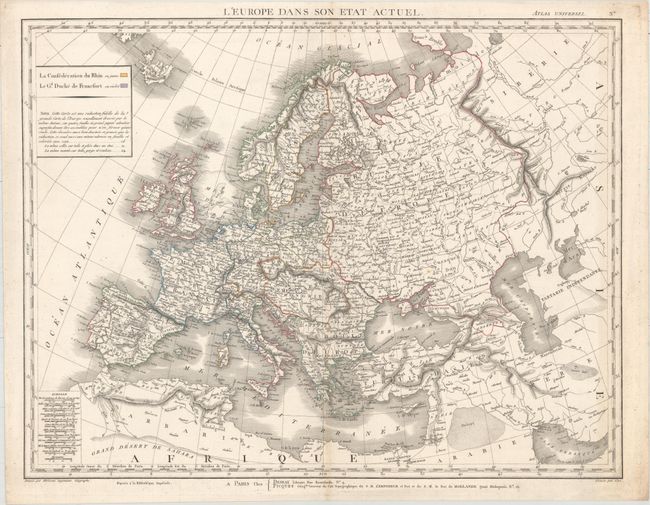
Subject: Europe

Period: 1810 (circa)

Publication: Atlas Universel

Color: Hand Color

Size:
25 x 19.3 inches
63.5 x 49 cm
Download High Resolution Image
(or just click on image to launch the Zoom viewer)

This map of Europe extends to include the Persian Gulf and part of northern Africa. Cities and rivers are shown, along with mountains depicted in hachure. There are interesting political boundaries due to the end of the War of the Fifth Coalition as part of the Napoleonic Wars, in which the French Empire was near its peak extent, extending south into Tuscany, Italy and north to encompass Belgium, Luxembourg, the Netherlands, and part of Germany. The Confederation of the Rhine, which existed from 1806-13, is outlined in yellow and the tiny Grand Duchy of Frankfurt is marked in purple. The Austrian Empire had also made significant gains during the wars, stretching to include the surrounding region from Prague to Brasov, Romania. Created by Eustache Herisson, engraved by Glot, and published by Desray and Picquet.

References:

Condition: B+

Original outline color with light soiling and minor toning along the centerfold at bottom.

Estimate: $550 - $700

Unsold

Closed on 6/22/2016

Archived