Catalog Archive
Auction 158, Lot 218

"Danish Islands in the North Atlantic Ocean", Fullarton, Archibald & Co.

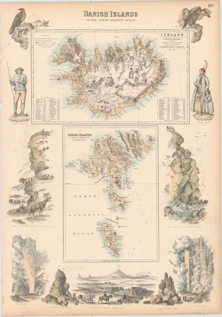
Subject: Iceland & Faroe Islands

Period: 1860 (circa)

Publication: The Royal Illustrated Atlas, Of Modern Geography

Color: Hand Color

Size:
12.1 x 17.6 inches
30.7 x 44.7 cm
Download High Resolution Image
(or just click on image to launch the Zoom viewer)

This sheet features two maps, the first showing Iceland and the second the Faroe Islands. The map of Iceland, drawn by Augustus Petermann and engraved by G.H. Swanston, depicts mountains, glaciers, snowfields, fjords, and hot and mineral springs. The elevations of the mountains (in feet) can be found in a list within the neatline. The Faroe Islands map, engraved by Swanston, similarly captures the topography of the land and shows many fjords and towns. Surrounding the plates are a series of fascinating vignettes showing figures in tradition Icelandic garb, Mount Hecla, geysers, reindeer, a seal, and other regional wildlife.

References:

Condition: B+

Original color with light toning along the edges of the sheet and binding holes at far left, several of which have caused tiny chips.

Estimate: $120 - $150

Sold for: $60

Closed on 6/22/2016

Archived