Catalog Archive
Auction 158, Lot 213

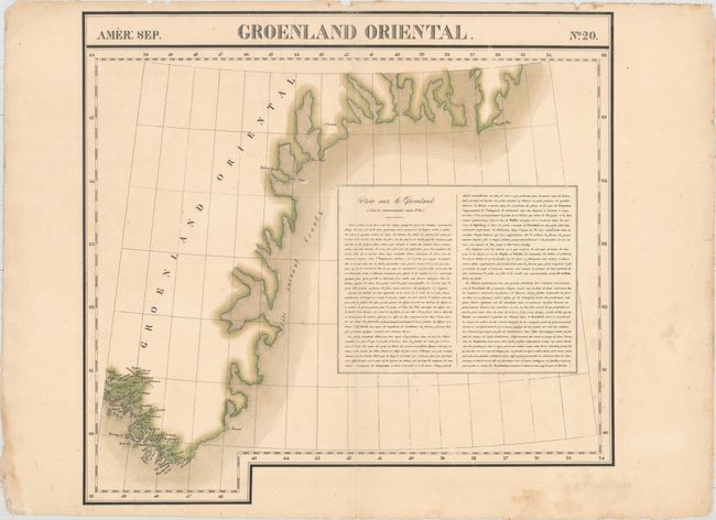
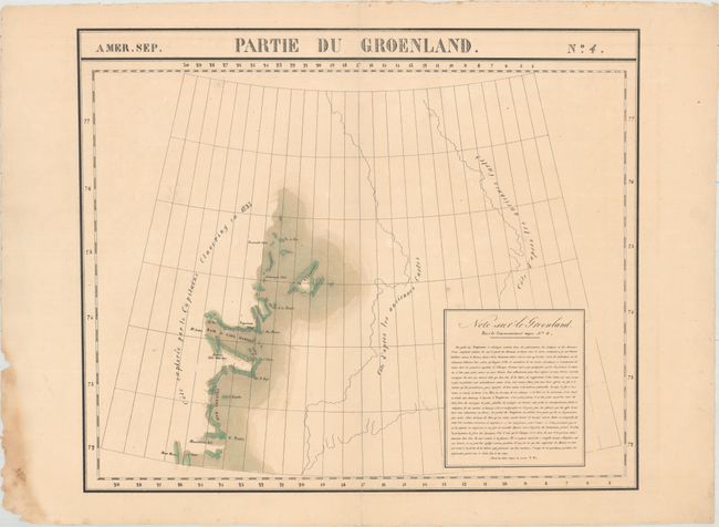
"[Lot of 2] Amer. Sep. Groenland Oriental. No. 20 [and] Amer. Sep. Partie du Groenland. No. 4", Vandermaelen, Philippe Marie Guillaume

Subject: Eastern Greenland

Period: 1825 (circa)

Publication: Atlas Universel de Geographie Physique, Politique, Statistique et Mineralogique...

Color: Hand Color

Size:
22.3 x 20.8 inches
56.6 x 52.8 cm
Download High Resolution Image
(or just click on image to launch the Zoom viewer)

Vandermaelen was the son of a wealthy industrialist who abandoned his father's business to follow a career in cartography. His goal was to produce the first atlas ever published in which every map was drawn on the same projection and to the same scale (1: 1,641,836), with each map covering an area of approximately 20 degrees of longitude (from Paris) and 6 degrees of latitude. Because of the consistent scale and projection, the maps could be joined together to form a huge globe that would measure over 25 feet in diameter. Vandermaelen had the only known globe constructed from his maps, requiring a special room for its display. It was also the first lithographic atlas ever published. There was one edition of the atlas, published in 1825-27, and the subscription list shows that only 810 copies were sold. Koeman called his Atlas Universel, "One of the most remarkable world atlases ever made. Far ahead of its time."

This lot features two handsome maps showcasing segments of Greenland's eastern coast, both with a block of informative French text about the region.

A. Amer. Sep. Groenland Oriental. No. 20. This sheet traces the southeast coast of Greenland down to Cape Farewell, the country's southernmost point. There are plenty of place names, almost all of them concentrated on the southern tip of Greenland. Condition: Original outline color with associated light toning and centerfold separations at top and bottom that have been closed on verso with archival tape. There are some small chips and short edge tears along the sheet's edges, including one that just enters the neatline at top that has been closed with archival tape on verso.

B. Amer. Sep. Partie du Groenland. No. 4. This map covers an incompletely mapped stretch of coastline explored by Arctic explorer Captain Douglas Clavering in 1823. Shannon Island, Esquimaux Village, and Hudsons Hold With Hope are among the places identified. Two conjectural coastlines drawn from earlier maps appear to the east. Condition: Original outline color with a couple minor spots and centerfold separations that have been closed on verso with archival tape.

The Atlas Universel contained 400 maps in six volumes. It was the first atlas made up of lithographed maps, and the first to present all the maps on the same scale (1: 1,641,836), with each map covering an area of approximately 20 degrees longitude (from Paris) and 6 degrees of latitude. If all the maps were joined together they would form a globe of 7.75 meters in diameter. The maps were published by subscription between 1825 and 1827, with each part containing ten maps. There was only one edition and the subscription list shows that 810 copies were sold; thus the maps are quite rare.

References:

Condition: B+

See description above.

Estimate: $250 - $325

Unsold

Closed on 6/22/2016

Archived