Catalog Archive
Auction 158, Lot 171

"A Map of Jamaica [on sheet with] Barbados", Speed/Lamb

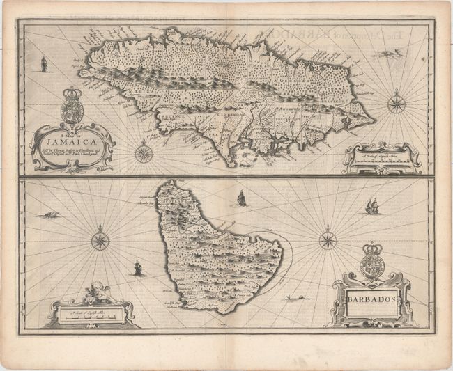
Subject: Jamaica & Barbados

Period: 1676 (circa)

Publication: A Prospect of the Most Famous Parts of the World

Color: Black & White

Size:
19.8 x 15.1 inches
50.3 x 38.4 cm
Download High Resolution Image
(or just click on image to launch the Zoom viewer)

This is one of the new maps that Francis Lamb engraved for the final edition of John Speed's great world atlas. At top is a fine map showing the precincts (parishes) in Jamaica, and at bottom is a detailed map of Barbados. Both islands were important British colonies in the West Indies. Each map is beautifully engraved to illustrated topography and richly adorned with cartouches, sailing ships, sea monsters, the royal arms, and compass roses. Basset and Chiswell's imprint is in the Jamaica cartouche. English text on verso contains fascinating descriptions of the islands.

References: Shirley (BL Atlases) T.SPE-2f #25.

Condition: A

A dark impression on watermarked paper with minor toning along the centerfold and light show-through of text on verso.

Estimate: $800 - $950

Sold for: $480

Closed on 6/22/2016

Archived