Catalog Archive
Auction 158, Lot 133

NO RESERVE

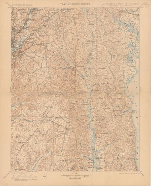
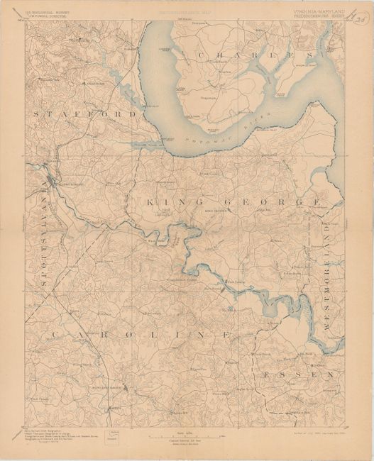
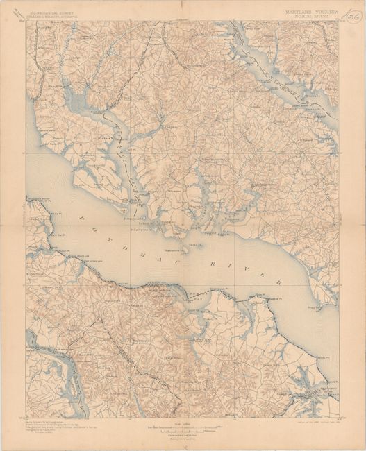
"[Lot of 4] Maryland - District of Columbia Patuxent Quadrangle [and] Virginia - Maryland Mt Vernon Sheet [and] Maryland - Virginia Nomini Sheet [and] Virginia - Maryland Fredericksburg Sheet", U.S. Geological Survey (USGS)
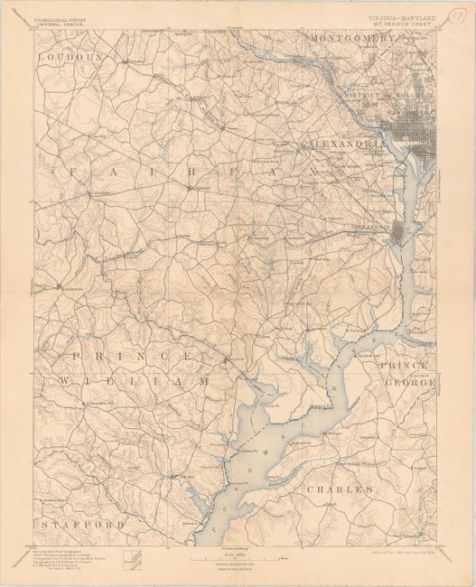
Subject: Washington, D.C.

Period: 1894-1905 (dated)

Publication:

Color: Printed Color

Size:
13.5 x 17.5 inches
34.3 x 44.5 cm
Download High Resolution Image
(or just click on image to launch the Zoom viewer)

Topographic map consisting of four contiguous sheets, not assembled:

A. Maryland - District of Columbia. Patuxent Quadrangle
B. Virginia - Maryland. Mt. Vernon Sheet
C. Maryland - Virginia. Nomini Sheet
D. Virginia - Maryland. Fredericksburg Sheet

The maps cover Washington, DC and vicinity with emphasis on the inland waterways below Washington. The Potomac River extends southeast from Great Falls to the Yeocomico River at the boundary between Westmoreland and Northumberland Counties. Fredericksburg, Virginia, is shown at the left center of the lower left sheet. The Rappahannock River is shown from Fredericksburg to Paynes Island in Essex County. The Patuxent River is shown in the two right sheets. Portions of the Chesapeake Bay are shown at the far right of the upper right sheet. Street patterns of Washington and surrounding towns are shown. The contour interval on the right sheets is 20 feet; that on the left sheets is 50 feet. This results in a slight difference in the appearance of the left and right sheets.

References:

Condition: B+

Mounted on linen with light toning on three of the four sheets. Each sheet has a small numbered pen mark in the blank margin, away from the image. Issued folding now flat.

Estimate: $180 - $220

Sold for: $26

Closed on 6/22/2016

Archived