Catalog Archive
Auction 157, Lot 745

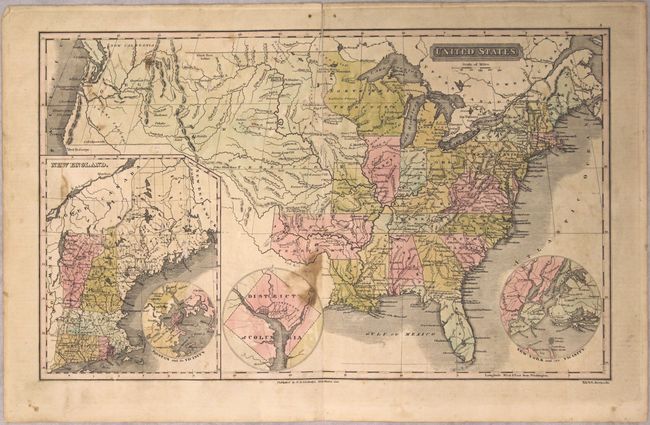
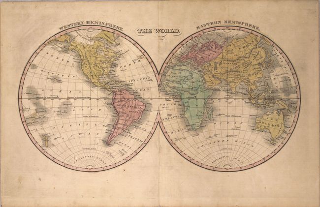
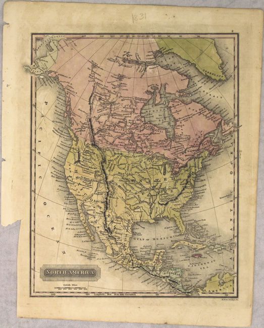
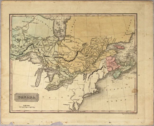
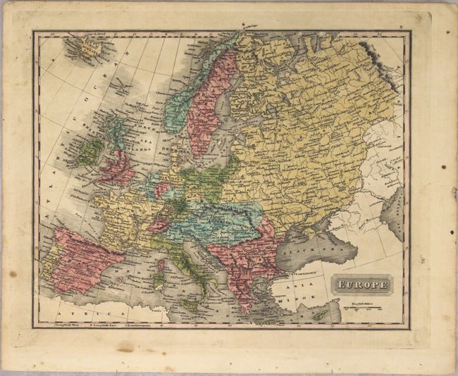
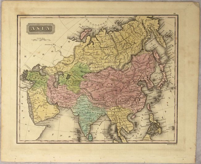
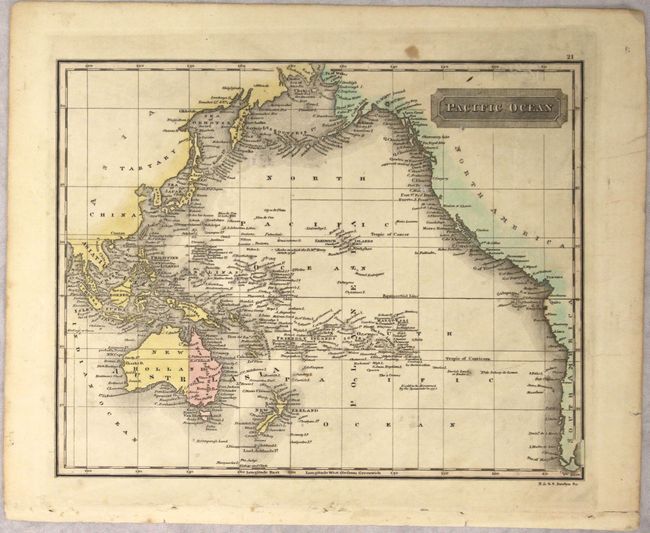
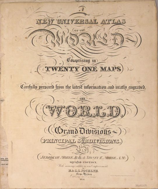
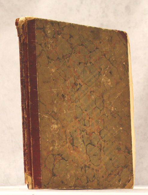
"A New Universal Atlas of the World Comprising in Twenty One Maps Carefully Prepared from the Latest Information and Neatly Engraved...", Morse, Jedidiah & Sydney

Subject: Atlases

Period: 1831 (published)

Publication:

Color: Hand Color

Size:
9.9 x 11.9 inches
25.1 x 30.2 cm
Download High Resolution Image
(or just click on image to launch the Zoom viewer)

This is the Morses' significant early American atlas, containing 18 of 21 issued maps including a double-hemisphere map of the world, North America, the United States, Canada, West Indies, Europe, its various nations, Asia, Hindoostan, and the Pacific Ocean. The atlas is missing the maps of South America, Spain & Portugal, and Africa. The double-page map of the United States, engraved by N. & S.S. Jocelyn, is cited in Wheat as being published in both Morse's An Atlas of the United States [1823] and the present example. The map features the Oregon country with the overly-long Multnomah (Willamette) River. There is no northern boundary shown, although the map of North America is colored to show the correct boundary to the Pacific. Title, table of contents, and 18 maps. Hardbound in original quarter leather with tips over marbled paper boards.

References: Wheat [TMW] #355.

Condition: B

Condition code is for the maps which are generally good with soiling, occasional foxing and staining, and light toning. Contents have completely separated from the binding and should be considered a collection of loose maps. The double-page map of the United States has a centerfold separation that extends 4" into the image at top that has been closed on verso with archival tape. The table of contents is in poor condition. Moderate wear to extremities.

Estimate: $600 - $800

Sold for: $300

Closed on 5/4/2016

Archived