Catalog Archive
Auction 157, Lot 743

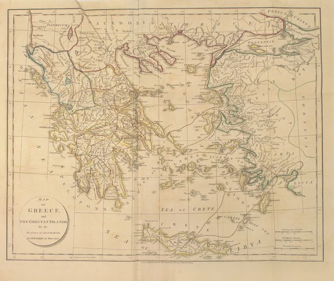
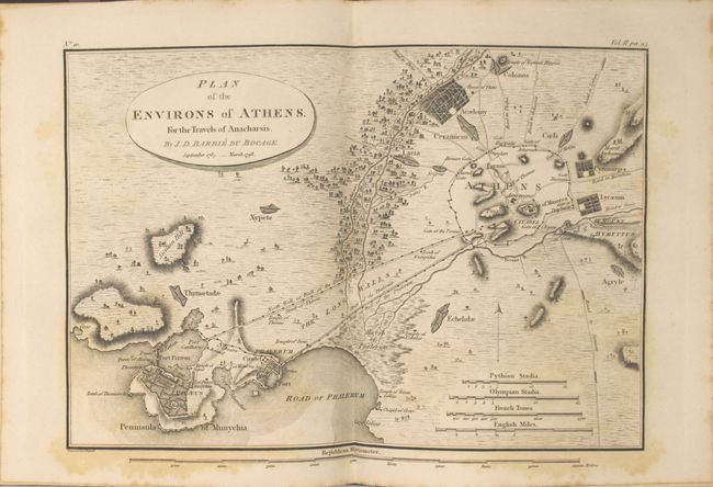
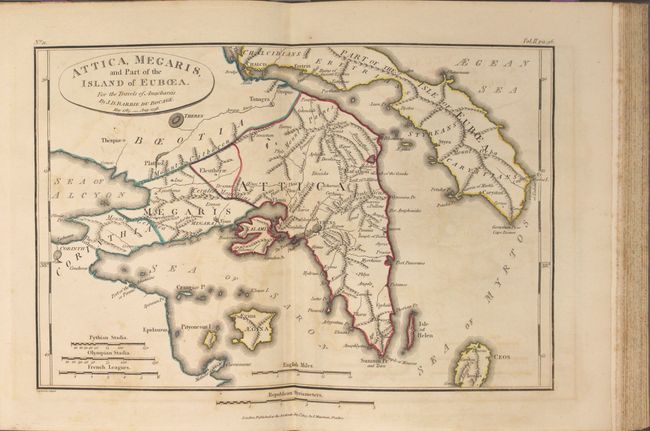
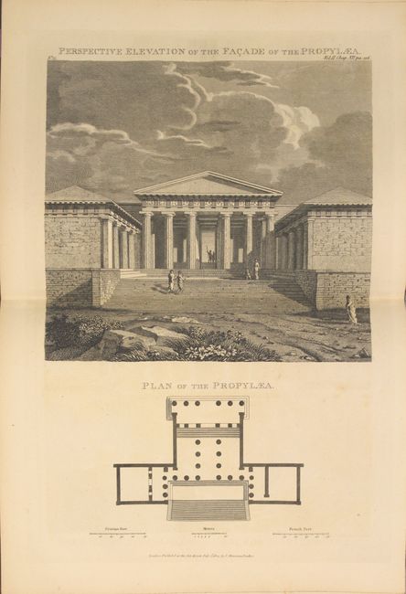
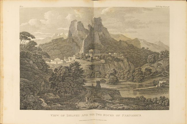
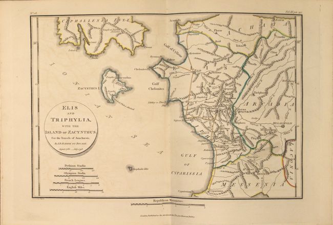
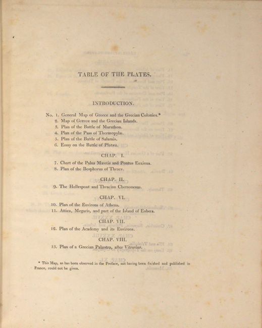
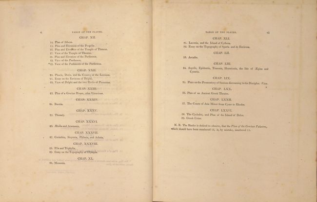
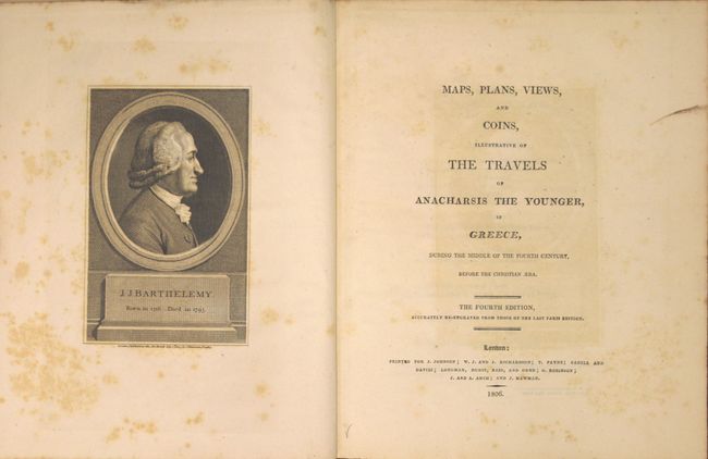
"Maps, Plans, Views, and Coins, Illustrative of the Travels of Anarcharsis the Younger, in Greece ... the Fourth Edition...", Barthelemy, Abbe Jean Jacques

Subject: Atlases, Ancient Greece

Period: 1806 (published)

Publication:

Color: Hand Color

Size:
8.7 x 10.8 inches
22.1 x 27.4 cm
Download High Resolution Image
(or just click on image to launch the Zoom viewer)

This is the fourth edition atlas volume to Barthelemy's work of the supposed travels of Anacharsis the Younger, a Scythian, throughout Greece between 404-354 BC. It contains a total of 38 plates (the table of contents calls for 39 but the first plate was not issued in this edition), most of which are maps, plans and views of Ancient Greece along with a few plates of buildings. The maps carry the imprint of Barbie du Bocage. Of particular interest is the folding Map of Greece, and the Grecian Islands which covers Greece, the islands of the Aegean Sea, and the adjacent coastline of Turkey. The map illustrates the numerous imaginary routes of Anacharsis with Crete shown at bottom. The atlas also includes two plans of Athens, a view of the Parthenon, and a view of Delphi to name a few. See images for a full list of plates.

In addition to the maps, there is a 112-page introduction discussing the maps of Ancient Greece by Barbie du Bocage and a frontispiece of Barthelemy. Hardbound in full leather with gilt stamped crown with initials "HST" on front cover. Spine gilt in compartments.

References: cf. Shirley (BL Atlases) G.BART-4a.

Condition: B+

Overall the maps and plates are very good with light offsetting and occasional scattered foxing. Text is clean and bright. Light wear to extremities with the front hinge starting.

Estimate: $350 - $450

Unsold

Closed on 5/4/2016

Archived