Catalog Archive
Auction 157, Lot 710

NO RESERVE

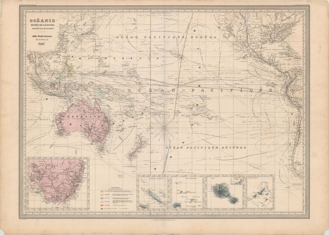
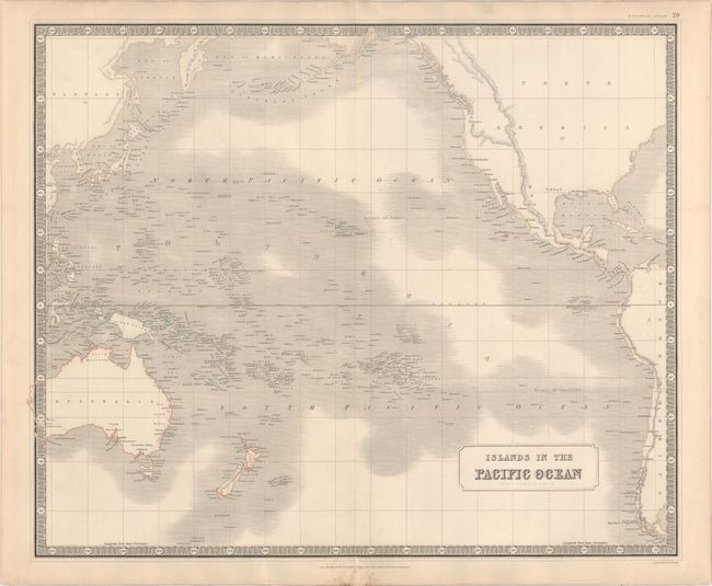
"[Lot of 2] Oceanie [and] Islands in the Pacific Ocean",

Subject: Pacific Ocean

Period: 1840-60 (circa)

Publication:

Color: Hand Color

Size:
See Description
Download High Resolution Image
(or just click on image to launch the Zoom viewer)

A. Oceanie, by Auguste-Henri Dufour, from Atlas Universel, circa 1860 (29.2 x 21.4"). This large format map features extensive navigational information in the Pacific, including ocean currents, wind directions during various times of the year, and routes with the number of days required to complete them. A colored key identifies the various possessions of the British, Spanish, French , Low Countries, and Portuguese. There are four small insets of New Caledonia, the Marquesas, Tahiti and the Gambier Islands. A large inset depicts the southern tip of Australia with notations of the gold-bearing regions. Condition: Original color with "Breton Freres" watermark, light soiling, and a centerfold separation that enters map border at bottom.

B. Islands in the Pacific Ocean, by W. & A.K. Johnston, from National Atlas, circa 1840 (24.0 x 19.7"). A detailed map of the Pacific Ocean identifying countless islands. The map includes the majority of Australia and North America, and parts of Asia and South America. Detail is confined to the coastlines with the exception of several mountain ranges depicted inland. Condition: Sturdy paper with a few minor creases, some foxing in bottom blank margin, and short centerfold separations at top and bottom.

References:

Condition: B+

See description above.

Estimate: $120 - $150

Unsold

Closed on 5/4/2016

Archived