Catalog Archive
Auction 157, Lot 529
"Regni Bohemiae, Duc. Silesiae, Marchionatuum Moraviae et Lusatiae Tabula Generalis...", Mayer/Homann Heirs
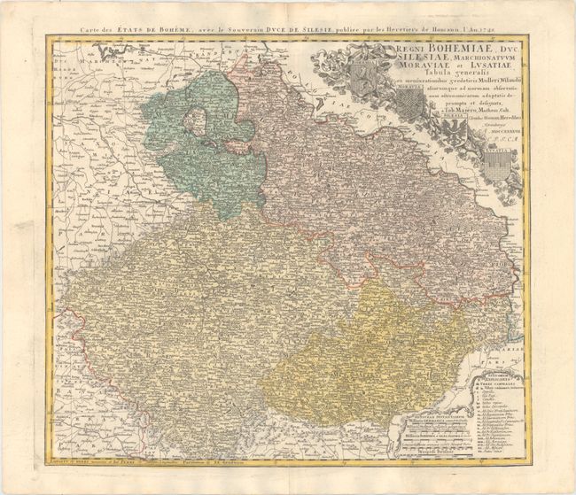
Subject: Czech Republic, Germany, Poland, Austria
Period: 1748 (dated)
Publication:
Color: Hand Color
Size:
21.1 x 18.7 inches
53.6 x 47.5 cm
Download High Resolution Image
(or just click on image to launch the Zoom viewer)
(or just click on image to launch the Zoom viewer)