Catalog Archive
Auction 157, Lot 389

"Map of the Windward Islands; Comprising Barbados, St. Vincent, Grenada, Tobago, St. Lucia & Trinidad...", Arrowsmith, John

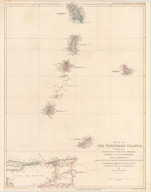
Subject: Windward Islands

Period: 1839 (dated)

Publication: Papers Relating to the Labouring Population of the West Indies

Color: Hand Color

Size:
18.3 x 24.5 inches
46.5 x 62.2 cm
Download High Resolution Image
(or just click on image to launch the Zoom viewer)

This map of the Windward Islands spans from Martinique south to Trinidad and Tobago, with a small sliver of Venezuela depicted as well. Political divisions, place names, and topographical detail are shown on each of the islands, and parentheses by each island's name specifies whether it is a British or French colony. Printed by James, Luke G., and Luke J. Hansard and published by the House of Commons.

References:

Condition: B+

Original color. Backed with tissue to reinforce and repair a number of small separations along the folds and light offsetting. Remargined at left and right.

Estimate: $240 - $300

Sold for: $120

Closed on 5/4/2016

Archived