Catalog Archive
Auction 157, Lot 371

Scarce Chart of Roatan

"The Island of Rattan", Heather/Norie

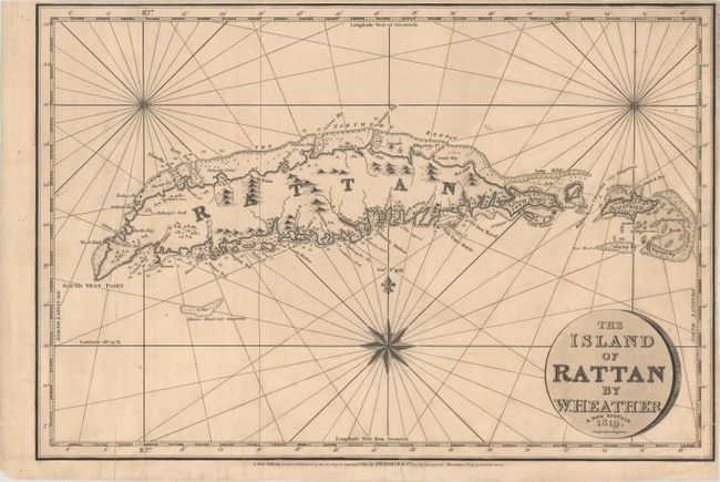
Subject: Roatan, Honduras

Period: 1827 (dated)

Publication:

Color: Black & White

Size:
18.6 x 12.6 inches
47.2 x 32 cm
Download High Resolution Image
(or just click on image to launch the Zoom viewer)

Finely engraved chart featuring the island of Rattan, known today as Roatan. There is good navigational detail along the coast, including soundings, rocks, shoals, and anchorages. In the 18th century New Port Royal was the location of a pirate settlement after an earthquake destroyed the original Port Royal in Jamaica. Engraved by Stephenson and published by J.W. Norie on January 1, 1827. This map was trimmed from a folio sheet that also contained maps of Bequia and Curacao.

References:

Condition: B

A dark impression with light soiling and two extraneous vertical creases at left. There are archival repairs to a chip confined to blank margin at bottom right and to several short tears along the edge of the sheet, entering from 1/4" to 1" into image. Narrow margins at top and right.

Estimate: $325 - $400

Sold for: $450

Closed on 5/4/2016

Archived