Catalog Archive
Auction 157, Lot 296

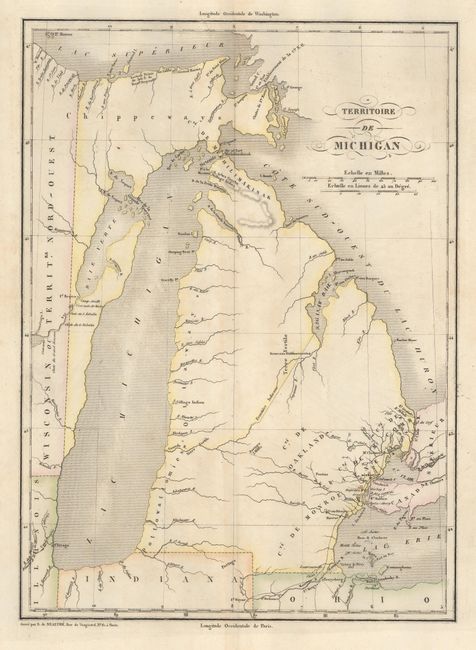
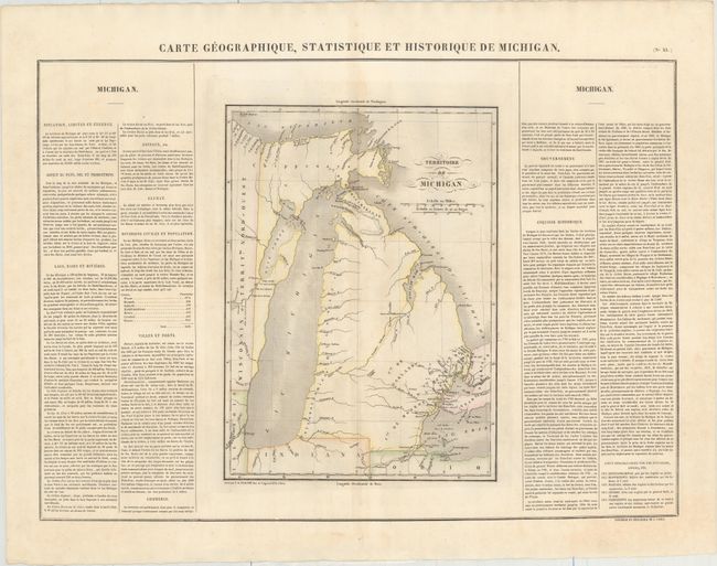
"Carte Geographique, Statistique et Historique de Michigan", Buchon, Jean Alexandre

Subject: Michigan

Period: 1825 (circa)

Publication: Atlas Geographique, Statistique, Historique et Chronologique…

Color: Hand Color

Size:
10.4 x 14.2 inches
26.4 x 36.1 cm
Download High Resolution Image
(or just click on image to launch the Zoom viewer)

This fine, early map of Michigan Territory is from the French edition of the Carey and Lea atlas. The western boundary is shown on a line 10° 30' West Longitude from Washington, resulting in Green Bay and a strip of present-day Wisconsin being incorporated into Michigan. The Frontiere Indienne divides lower Michigan on a diagonal line. The only settlements shown are in the southeast around Detroit, and along the Saginaw River is a Nouveaux Establissements. The initial counties of Michilimakinak, Monroe, Oakland, DeWayne, and Macomb are named but not delineated. There is a road depicted from Ft. Wayne, Indiana, to Mt. Clemens. The rest of the territory is virtually blank except for a few portages and Indian villages. Several battlegrounds from the War of 1812 are located by tiny flag symbols. The whole sheet measures 27.0 x 21.1" and includes panels of French text providing a detailed history of the region with the total population of 8,496 divided among seven counties.

References:

Condition: B+

There is light toning along the centerfold and light soiling.

Estimate: $325 - $400

Sold for: $300

Closed on 5/4/2016

Archived