Catalog Archive
Auction 157, Lot 276

"Map of the Seat of War in Florida Compiled By Order of Bvt. Brigr. Genl. Z. Taylor…", U.S. War Department
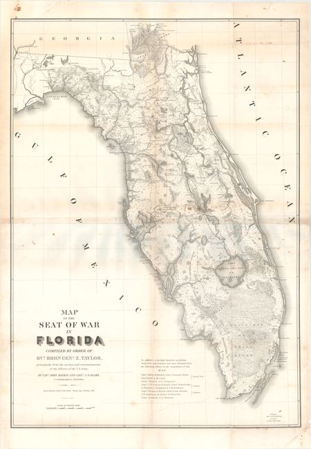
Subject: Florida

Period: 1839 (dated)

Publication:

Color: Black & White

Size:
28.5 x 39.8 inches
72.4 x 101.1 cm
Download High Resolution Image
(or just click on image to launch the Zoom viewer)

This large, remarkable map of Florida at the time of the 2nd Seminole War was drawn by Capt. John Mackay and Lieut. J.E. Blake. There is great detail of Army forts, battlegrounds, Seminole villages, vegetation, hydrology, and a large network of roads and trails; many labeled with the related military action. Crossed swords are used as an icon to locate battles. Hand colored in outline to designate the District assigned to the Seminoles by the Arrangement of Gen. Macomb on May 18, 1839. The panhandle west of Tallahassee and the Ocklockonee River is not included. On two joined sheets.

References: Claussen & Friis #316; Phillips (M) p. 284; cf. Schwartz & Ehrenberg, plt. 160.

Condition: B

Backed with tissue to reinforce and repair numerous small fold separations and several tears including one at bottom that extends 8" into the image and 7" tears at left and right. Light toning along the folds and scattered foxing.

Estimate: $700 - $850

Sold for: $550

Closed on 5/4/2016

Archived