Catalog Archive
Auction 157, Lot 272

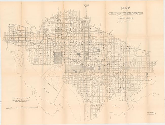
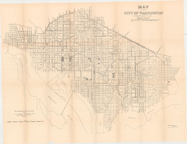
"[Lot of 3] Map of the City of Washington Showing the Varieties of Street Pavements on January 1st 1886 [and] ...Showing the Location of the Water Mains [and] ...Showing the Location of the Sewers",
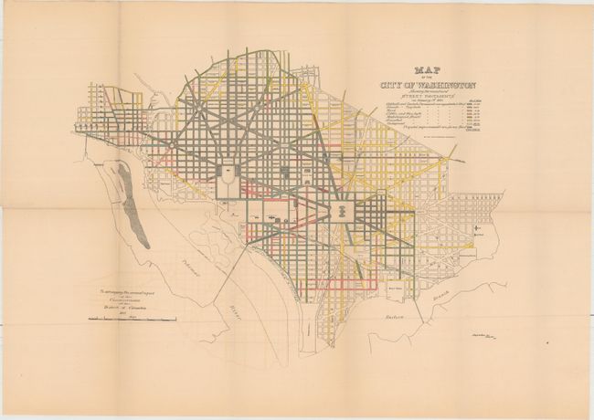
Subject: Washington, D.C.

Period: 1886 (circa)

Publication:

Color:

Size:
See Description
Download High Resolution Image
(or just click on image to launch the Zoom viewer)

These three thematic maps were published in the Annual Report of the Commissioners of the District of Columbia. Beginning in the early 1870's, population growth exploded and the city lacked the basic infrastructure to support it. In 1874, Congress created a three-person Board of Commissioners to become the permanent government for the District. Over the next several decades, much was done by the Commission to improve living conditions and infrastructure including paved roads, new water lines, and upgraded sewer capacity. These maps reflect the progress of those efforts.

The maps carry the title "Map of the City of Washington..." showing the street pattern of Washington in great detail. Each has a specialized focus and legend, with the titles continuing:

A. ...Showing the Varieties of Street Pavements on January 1st 1886, printed color (19.2 x 13.9").

B. ...Showing the Location of the Water Mains, black & white (38.3 x 28.5").

C. ...Showing the Location of the Sewers, black & white (38.2 x 27.5").

References:

Condition: B+

Issued folding with light toning and a few short splits at fold intersections. The first map also has faint color offsetting.

Estimate: $250 - $325

Sold for: $170

Closed on 5/4/2016

Archived