Catalog Archive
Auction 157, Lot 202
"Der Amerikanische Kriegsschauplatz Zwischen Baltimore & New York", Petermann, Augustus Herman
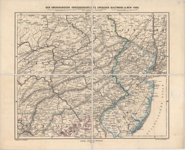
Subject: Mid-Atlantic United States, Civil War
Period: 1862 (dated)
Publication:
Color: Hand Color
Size:
15.5 x 12.8 inches
39.4 x 32.5 cm
Download High Resolution Image
(or just click on image to launch the Zoom viewer)
(or just click on image to launch the Zoom viewer)