Catalog Archive
Auction 157, Lot 200

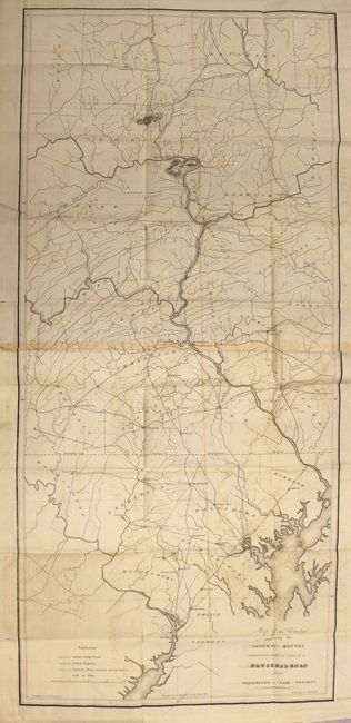
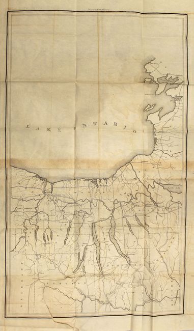
"[Bound in Report] Map of the Country Embracing the Several Routes Examined with a View to a National Road from Washington to Lake Ontario", U.S. War Department

Subject: Mid-Atlantic United States

Period: 1828 (published)

Publication: HR Doc. 38, 20th Congress, 2nd Session

Color: Black & White

Size:
17 x 37 inches
43.2 x 94 cm
Download High Resolution Image
(or just click on image to launch the Zoom viewer)

This pair of early maps reflect the federal government's early concern for providing a viable transportation system across the country. The detailed and interesting maps were based on a map by Col. Stephen H. Long, compiled by F. Harrison, Jr., drawn by A.J. Stansbury, and engraved on copper by W. Harrison. The first sheet covers an 80-mile section from just below Washington D.C. to Athens, PA, on a scale of five miles to the inch. The various routes run through Harrisburg, Williamsport, Baltimore and Lancaster. The second map is untitled and shows the road system north of the Susquehanna River to Lake Ontario. Both are filled with great detail of country roads, turnpikes, towns and even locates taverns and stores. Each is printed on two joined sheets. Size given is for the first map, the second untitled map measures 17 x 28.5". Still bound with 22 pp. report.

References:

Condition: B

Light to moderate offsetting, light toning along the sheet joints, and a few tiny splits at fold intersections. The untitled map has a tear at left that extends 2" into the image. Report text is toned and foxed.

Estimate: $200 - $250

Sold for: $220

Closed on 5/4/2016

Archived