Catalog Archive
Auction 156, Lot 83
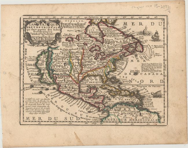
"L'Amerique Septentrionale qui Fait Partie des Indes Occidentales. Dressee Selon les Dernieres Relations des Voiageurs et Suivant les Nouvelles Observations de Mur. de l'Academie Royale des Sciences", Chiquet, Jacques
1 of 2
Subject: North America
Period: 1719 (dated)
Publication: Le Nouveau et Curieux Atlas Geographique et Historique
Color: Hand Color
Size:
8.6 x 6.6 inches
21.8 x 16.8 cm
Download High Resolution Image
(or just click on image to launch the Zoom viewer)
(or just click on image to launch the Zoom viewer)