Catalog Archive
Auction 156, Lot 808

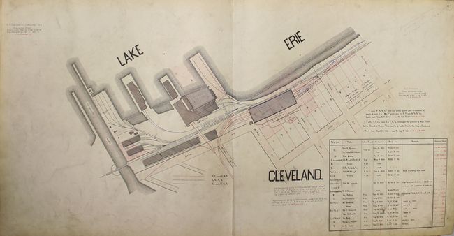
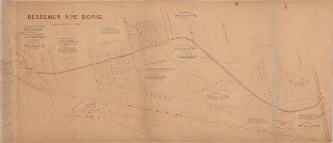
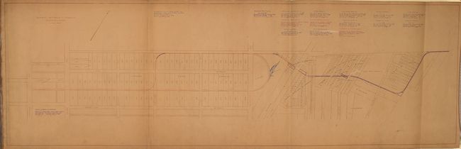
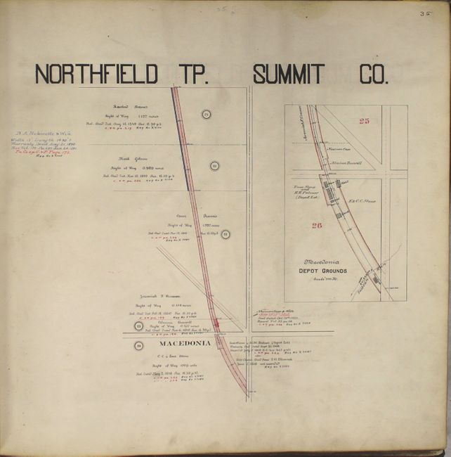
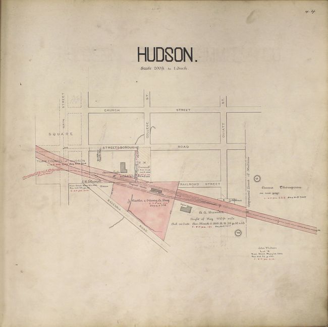
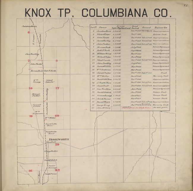
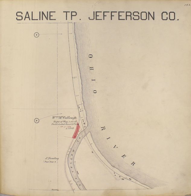
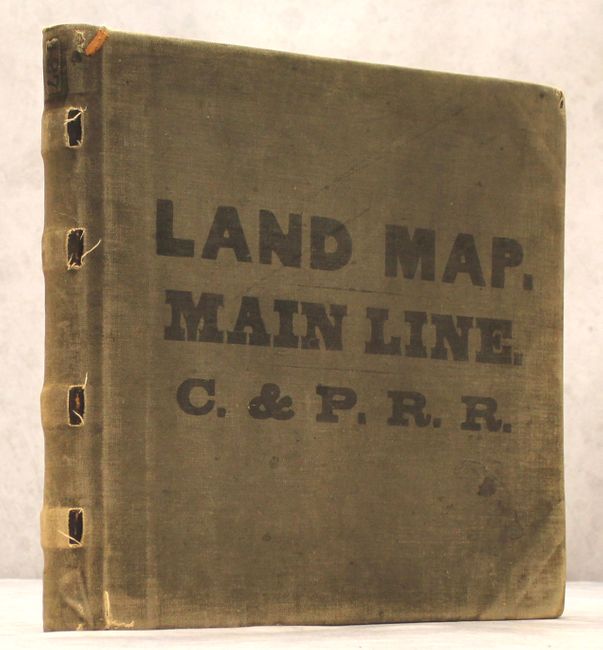
One-of-a-Kind Manuscript Railroad Atlas

"[Manuscript Railroad Atlas] Land Map. Main Line. C. & P.R.R.", Railroad Companies, (Various)

Subject: Atlases, Ohio

Period: 1890 (circa)

Publication:

Color: Hand Color

Size:
16.9 x 16.3 inches
42.9 x 41.4 cm
Download High Resolution Image
(or just click on image to launch the Zoom viewer)

This fascinating manuscript atlas is a unique and important working document showing the Cleveland & Pittsburgh Railroad land transactions in northern and eastern Ohio. The 142 pages of maps depict the line as it travels from Cleveland to Ravenna, Columbiana, and finally Saline Township along the Ohio River. Each map shows the extent of right of way, deed purchases and dates, and the names of grantors. The atlas also includes two large folding maps backed on linen showing portions of Cleveland entitled "Dart Street Track" (46.5 x 14.5") and "Bessemer Ave. Siding" (34.5 x 15"). Many of the maps are enhanced with red and blue hand coloring. Folio, hardbound in gray cloth.

The Cleveland & Pittsburgh Railroad was founded in 1836 and was the first railroad to serve the Cleveland area. It reached its goal of connecting Cleveland to Pittsburgh in the 1850s and was taken over by the Pennsylvania Railroad Company in 1871.

References:

Condition: B

The maps are good to very good with light to moderate soiling from use, occasional extraneous pencil notations, and a couple of edge tears and chips (some of which have been repaired on verso). The binding is loose with the Bessemer Ave. folding map separated from the text block. The moderately bumped and worn covers and spine have separated from the text block.

Estimate: $1,000 - $1,500

Unsold

Closed on 2/17/2016

Archived